A 9 km journey that takes you along the Elbow River to its confluence with the Bow.
This is more than just a meeting of two rivers. It explores spaces where people have traditionally gathered and how cultures often develop through a connection to the land.
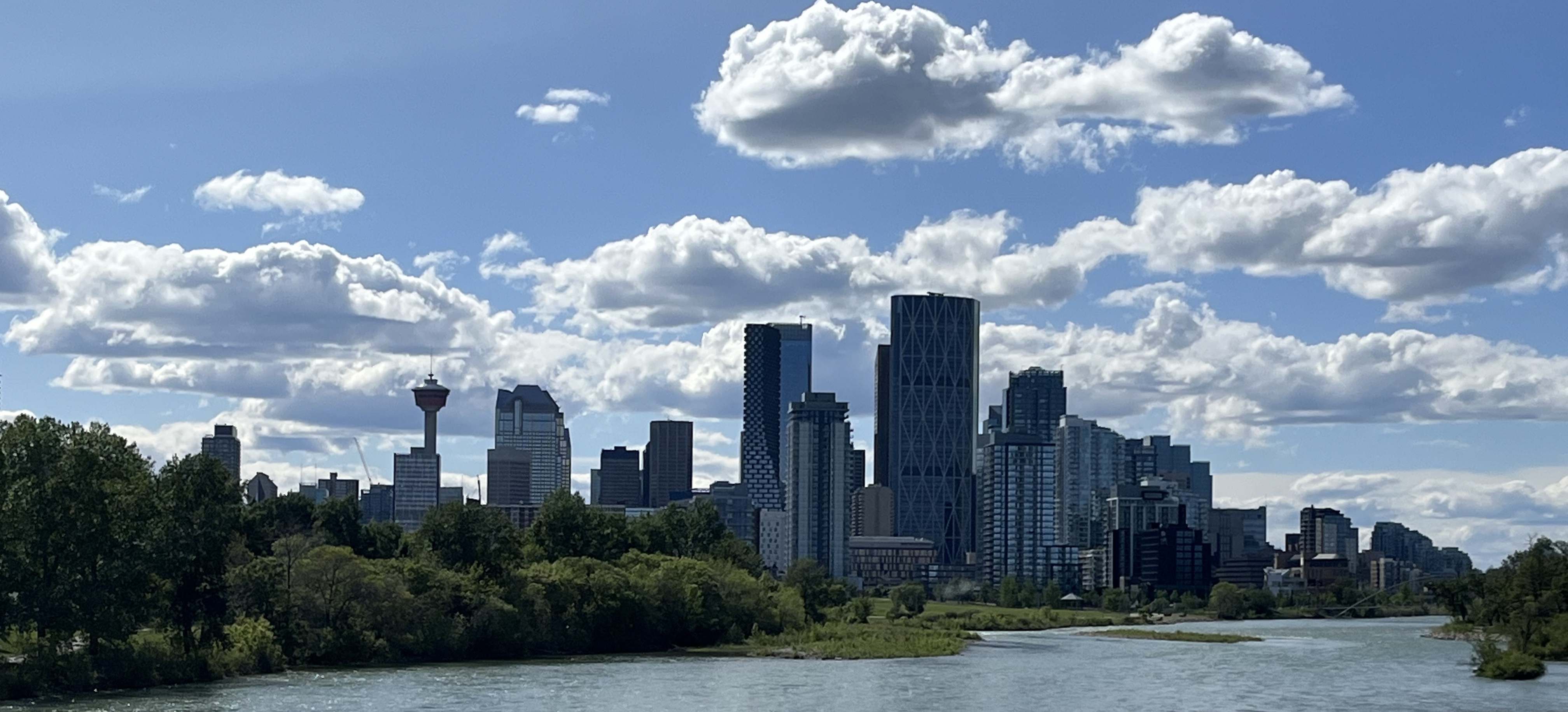
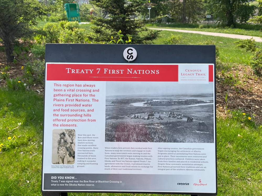
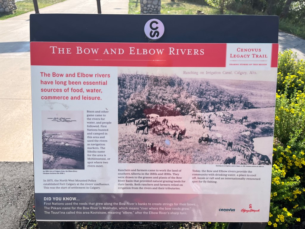
Calgary’s story began here. Long before settlers established a community, it was a place of gathering and ceremony. Indigenous peoples called it Mohkinstsis or “Elbow” in the Blackfoot language.
Every society, in one way or another, lays claim to a territory. Within that claimed territory, a culture arises from the mutual relationship with the land. Through this relationship, culture icons, symbols and images, values, customs, ceremonies, stories, songs and beliefs of the people are developed. These, in turn, are embodied into the very being of the people
Dr. Leroy Little Bear: Professor, Order of Canada, Kainai Nation, Blackfoot Confederacy, 2017. Plaque outside of King Edward School in South Calgary.
A connection to the land is central to Indigenous cultures. They often named places based on the features or activities that occurred there.
Fort Calgary
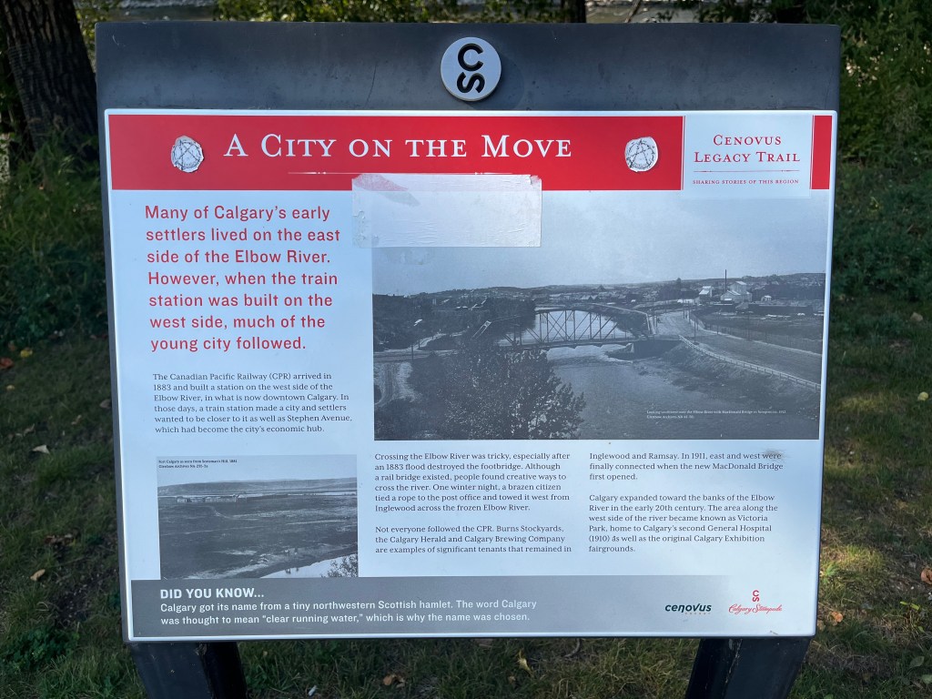
The history of this area is a nuanced story. Fort Calgary was established on the west side of the Elbow River in 1875. It was a base for the North-West Mounted Police to prepare the area for settlement after the confederation of Canada.

“A series of carved wood members punctuated with traces of red light outline the original 1875 Fort Calgary, embodying its impermanence and dynamic energy. Silhouettes of people from this site’s past and present appear and disappear within the palisade, reminiscent of the way the wind blows shapes across the southern Alberta grasses”. Installed in 2015 by artist Jill Anholt and team.
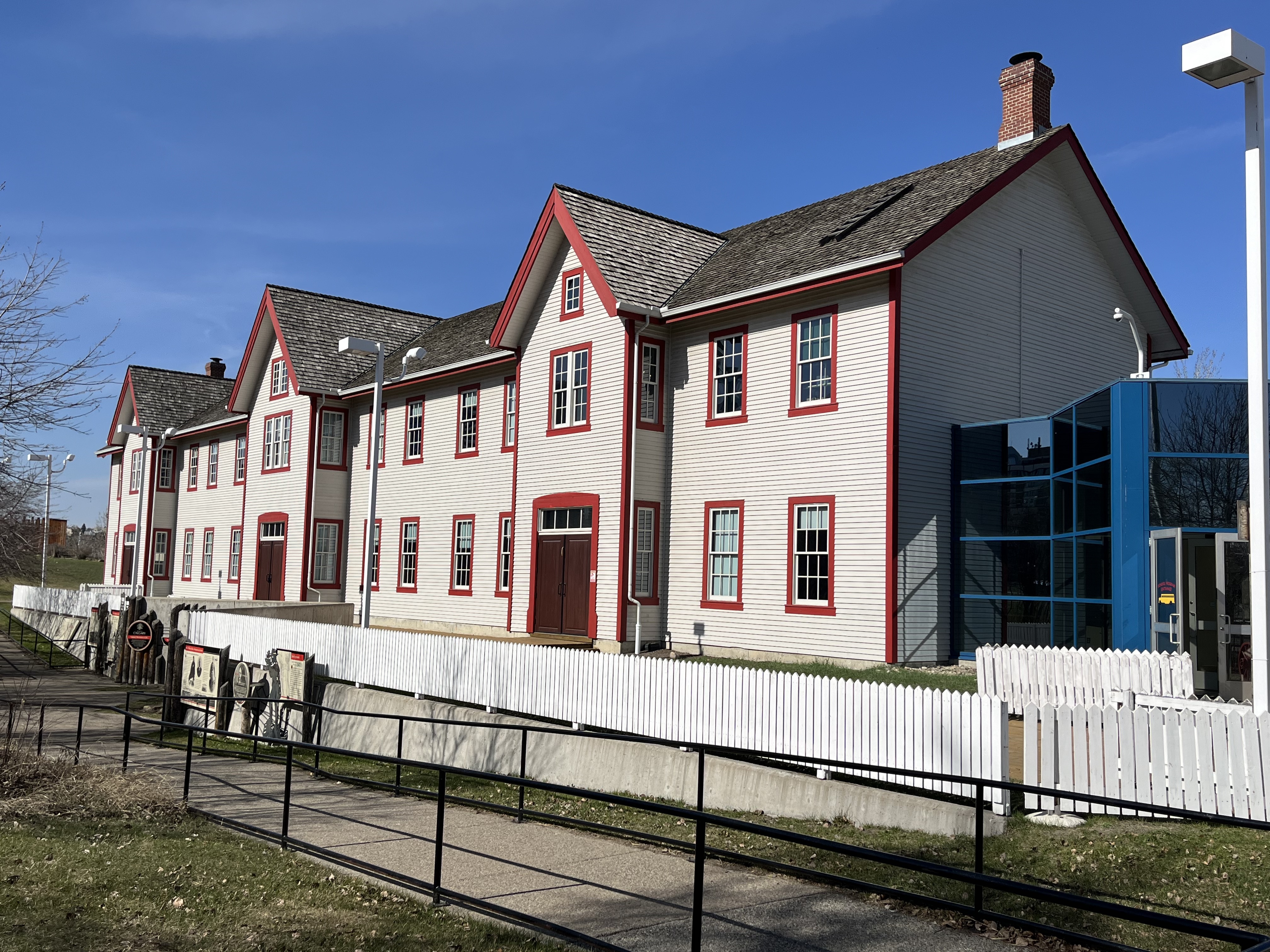
A replica of the two-storey barracks was completed beside the wooden frame of the original fort in 2000. There is an interpretive centre with exhibits and educational programming providing insights into Indigenous cultures. The site also hosts other events, concerts and celebrations.
Plus, there are self-guided tours to explore the confluence.
EAST VILLAGE
Fort Calgary is in the East Village, an evolving area east of downtown undergoing significant revitalization after decades of underutilization. The neighbourhood is transforming into a dynamic hub with a diverse mix of income and uses. It incorporates residential, commercial, and cultural development.

There is a community garden, a dog walk and plenty of public spaces to gather. Explore the gazebo by the pond, playground and two of the Best Outdoor Basketball Courts in the city.
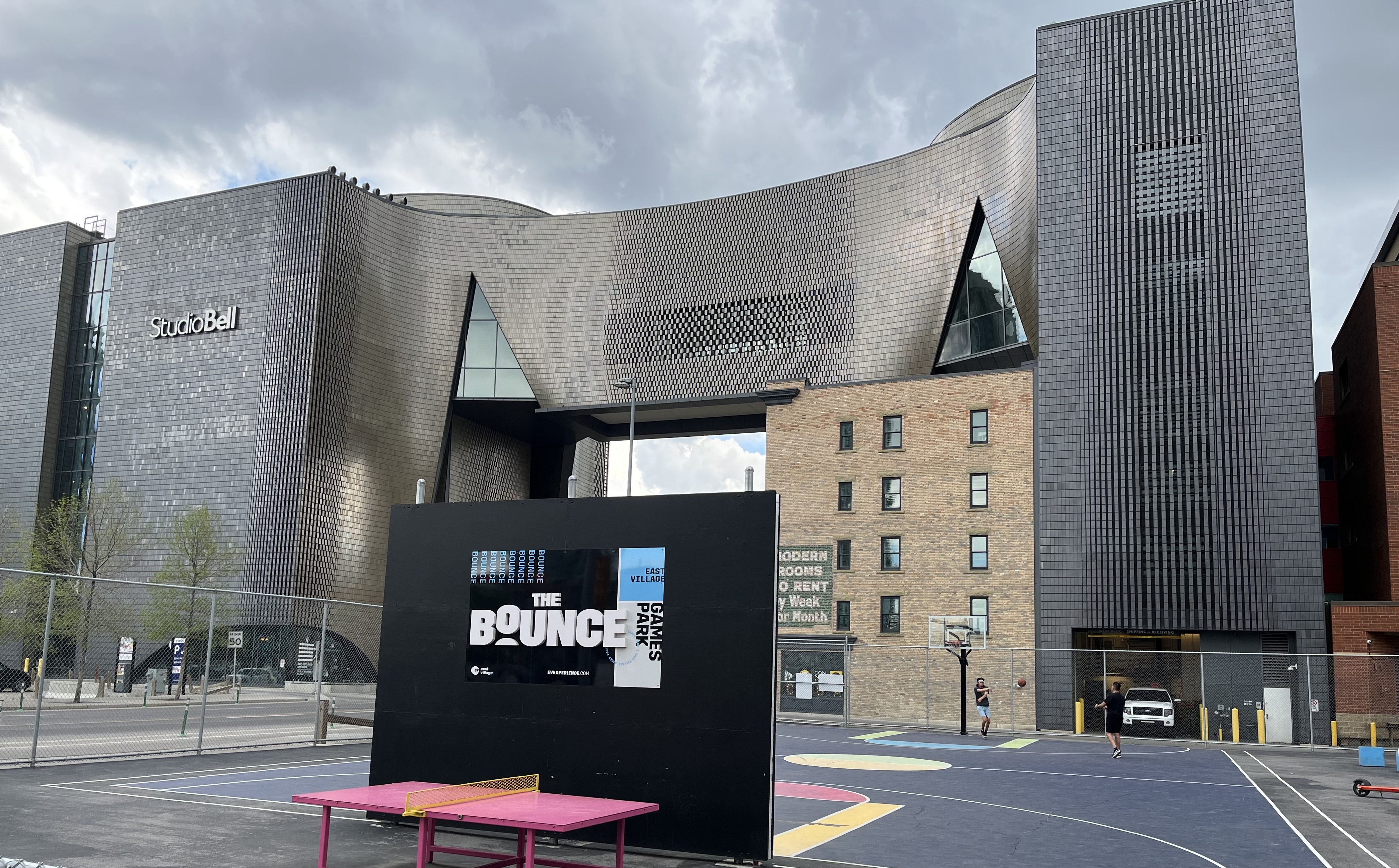

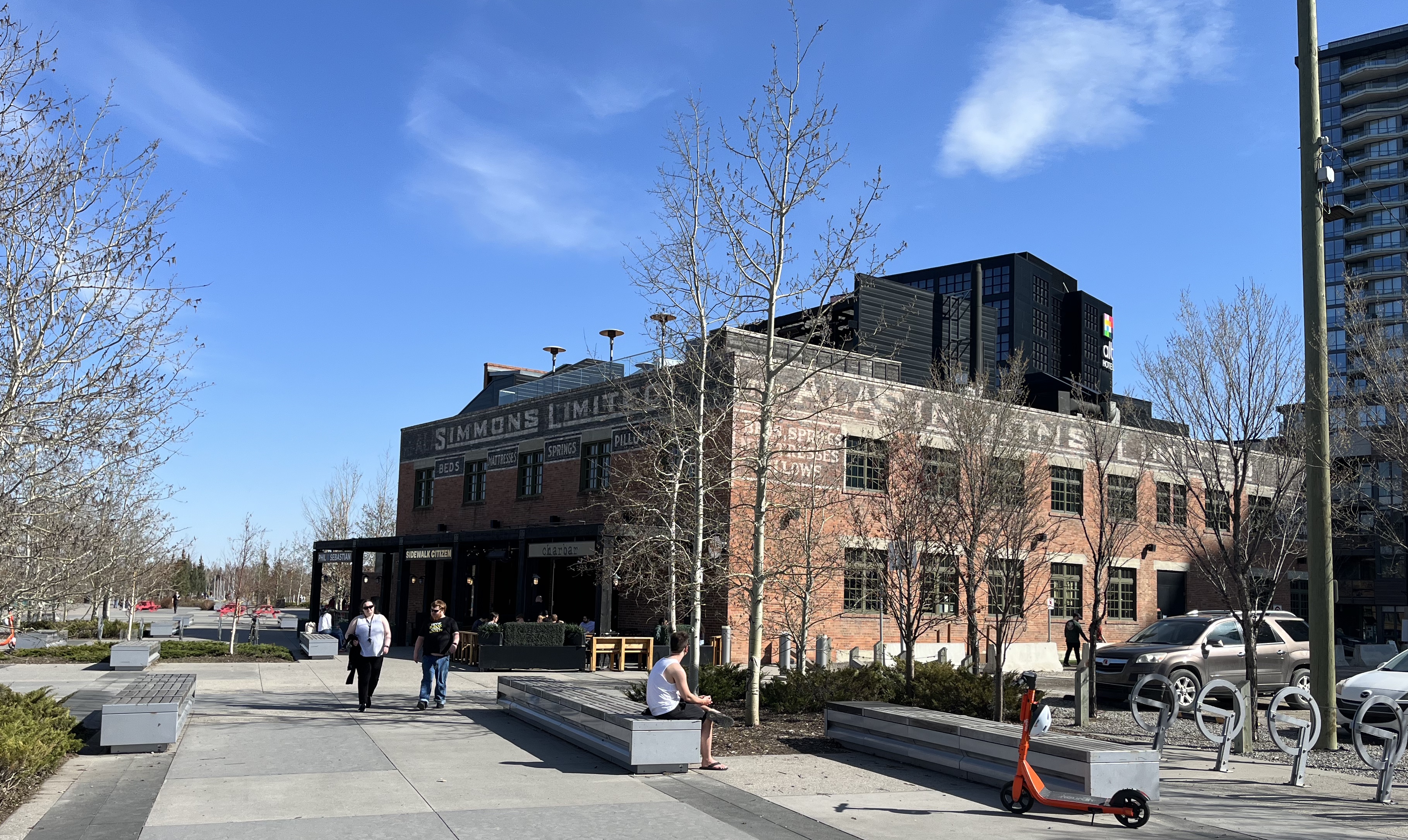

The East Village incorporates public art, heritage buildings and contemporary architecture. Notable examples to explore include Studio Bell, Central Library and the Simmons building on RiverWalk Plaza.

RiverWalk Plaza hosts many events throughout the year. These include food trucks, artisan markets, Beakerhead festivities and other festivals. The site features benches, outlooks over the water, and access to steps down to the Bow River, plus the RiverWalk.
The East Village is connected to the 23,000 km Trans Canada Trail. It is also linked to the local 900 km network of pathways and bikeways. RiverWalk offers dedicated pedestrian and bike lanes with scenic views of downtown along a manicured greenspaces incorporated into a flood mitigation network
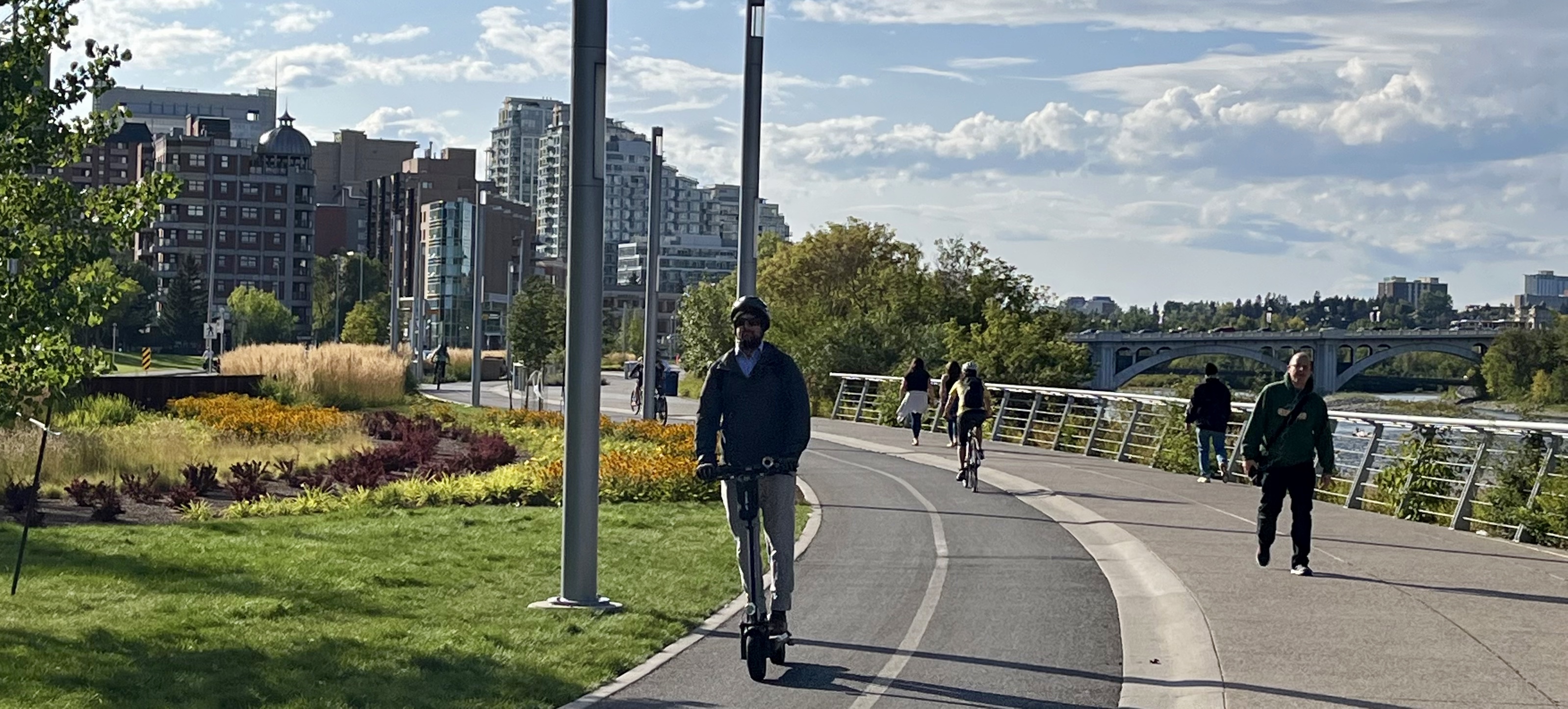
The section of the RiverWalk from Centre Street Bridge – RiverWalk to 9th Avenue is approximately 1.9 km. From here, you can cross the bridge to explore Inglewood – Urban Sanctuary. Or follow the pathway along the Elbow River to Legacy Trail.
LEGACY TRAIL
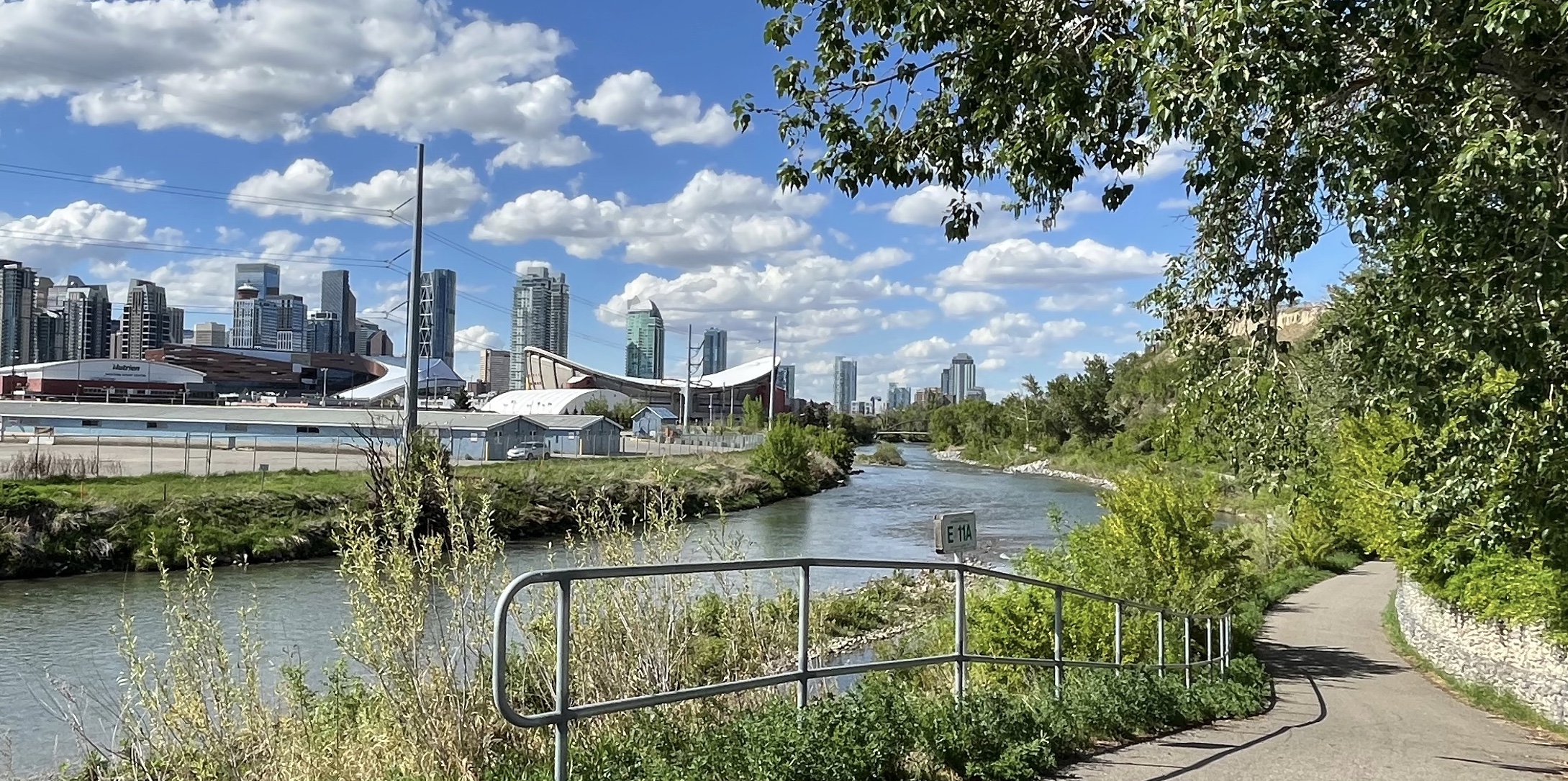
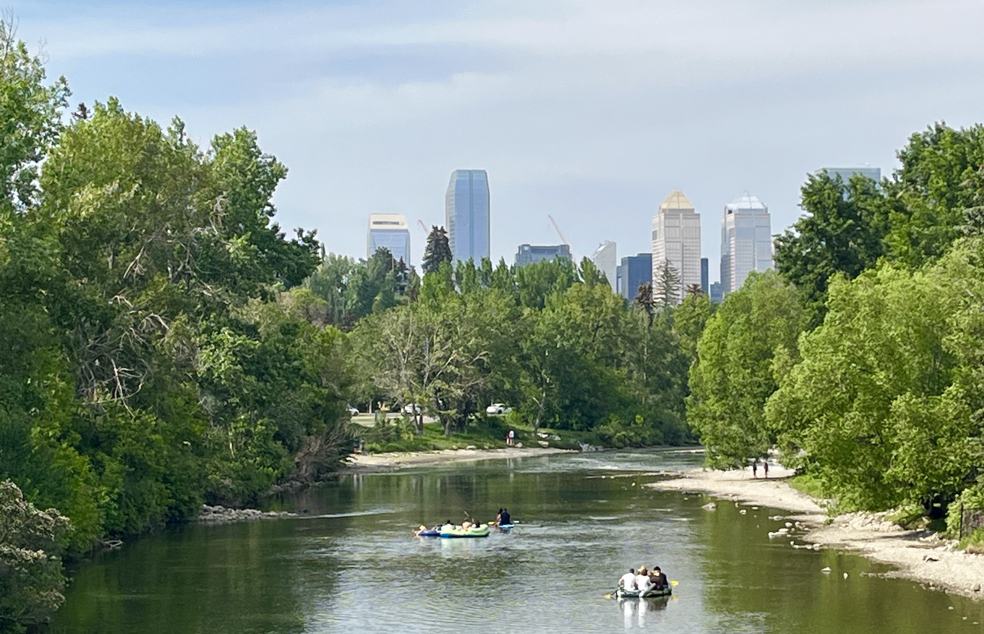
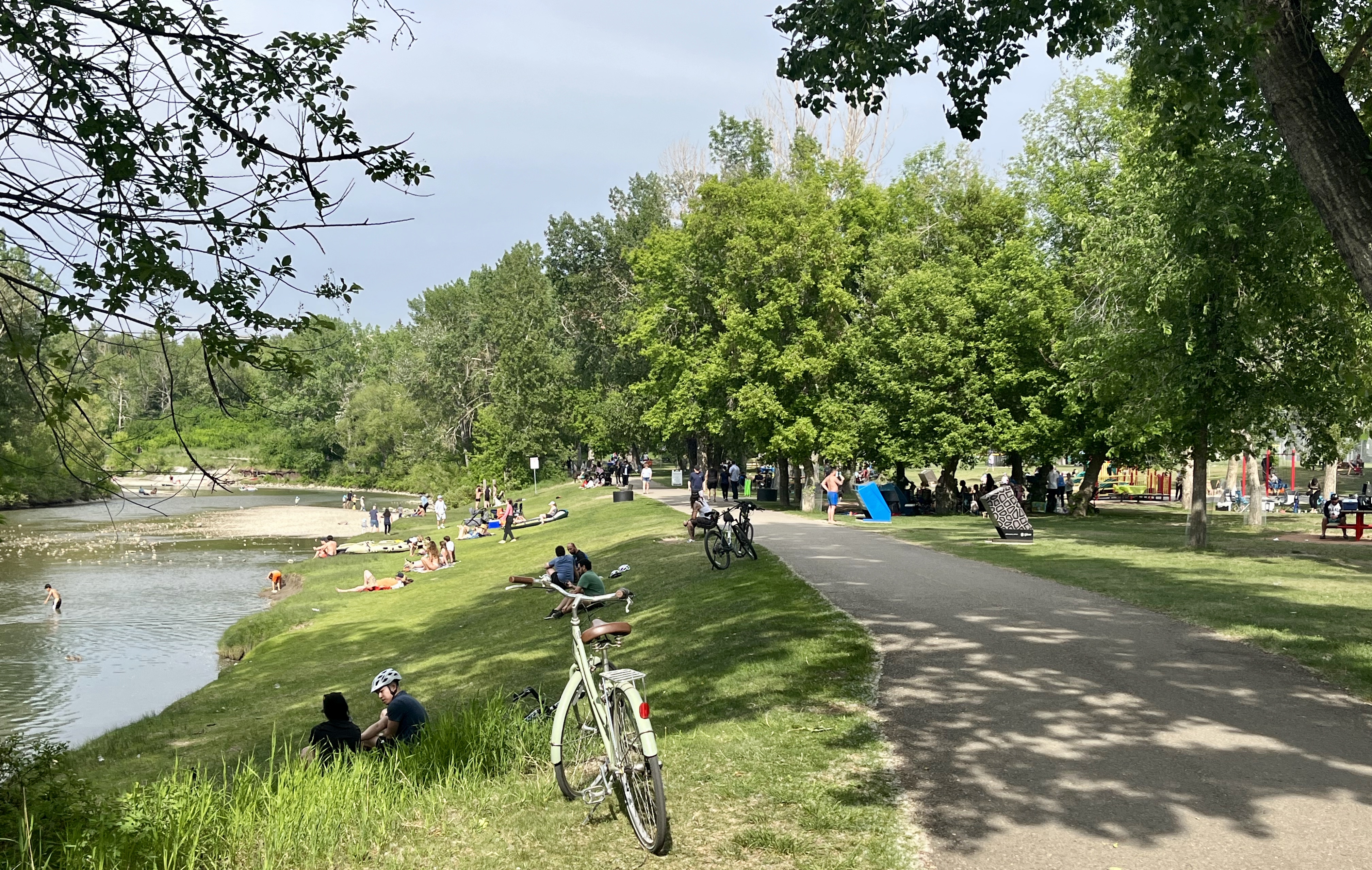
Following the Elbow River from the Riverwalk to the Glenmore Dam is 9.1 km. It can be explored as an urban hike, run, bike, scoot or by raft. It is full of destinations, areas of interest and gathering places.
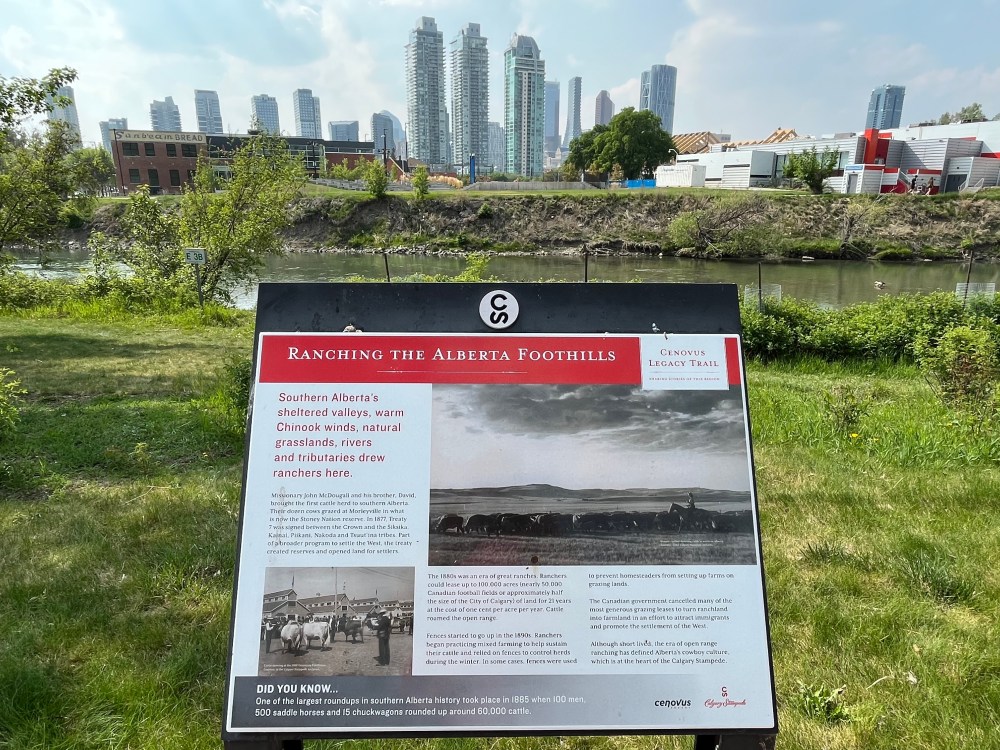
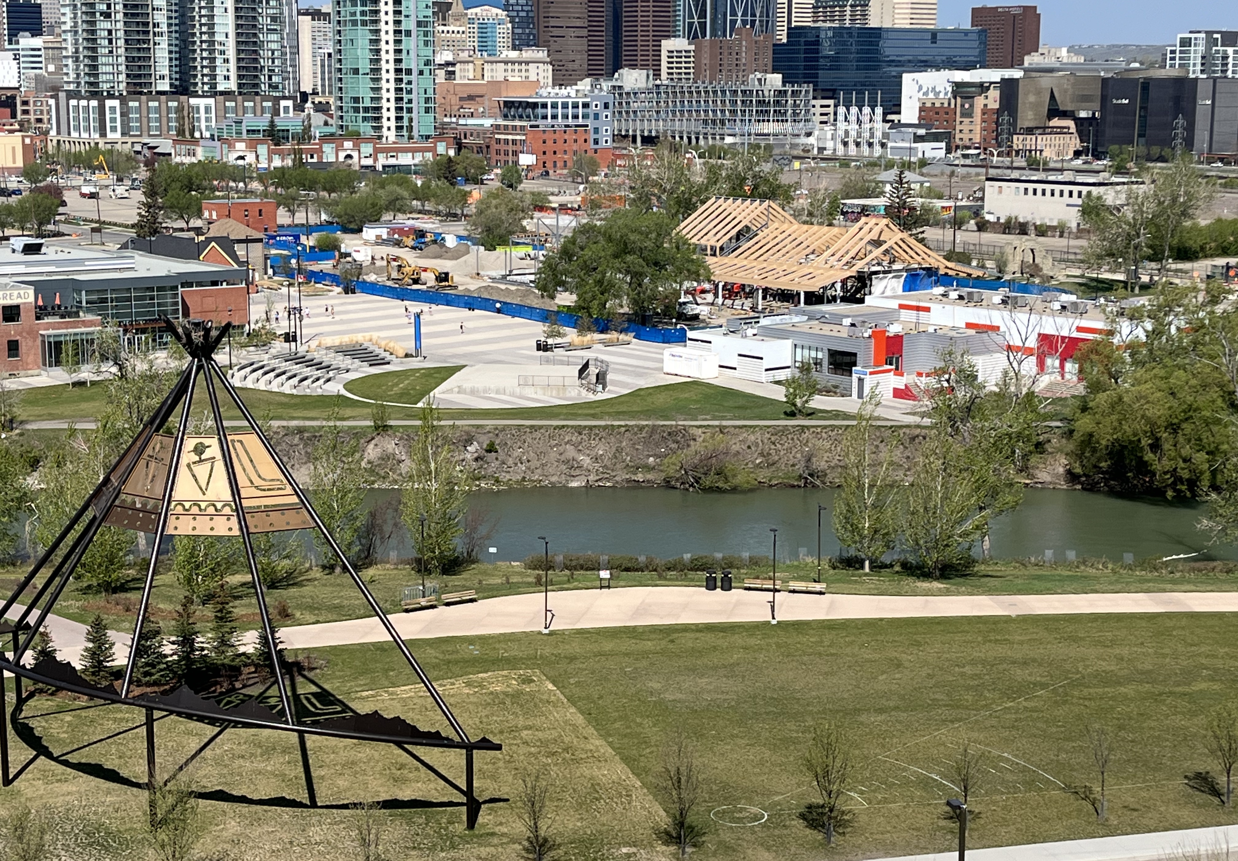
The first area of interest is ENMAX Park. A 16 acre green space and home to the 650 metre-long Cenovus Legacy Trail. It features markers telling the story of the land through the lenses of First Nations People, Calgary and the Stampede.

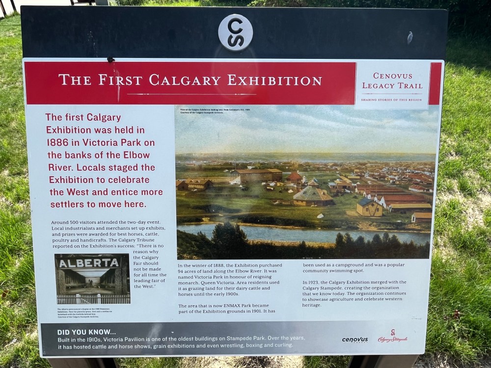

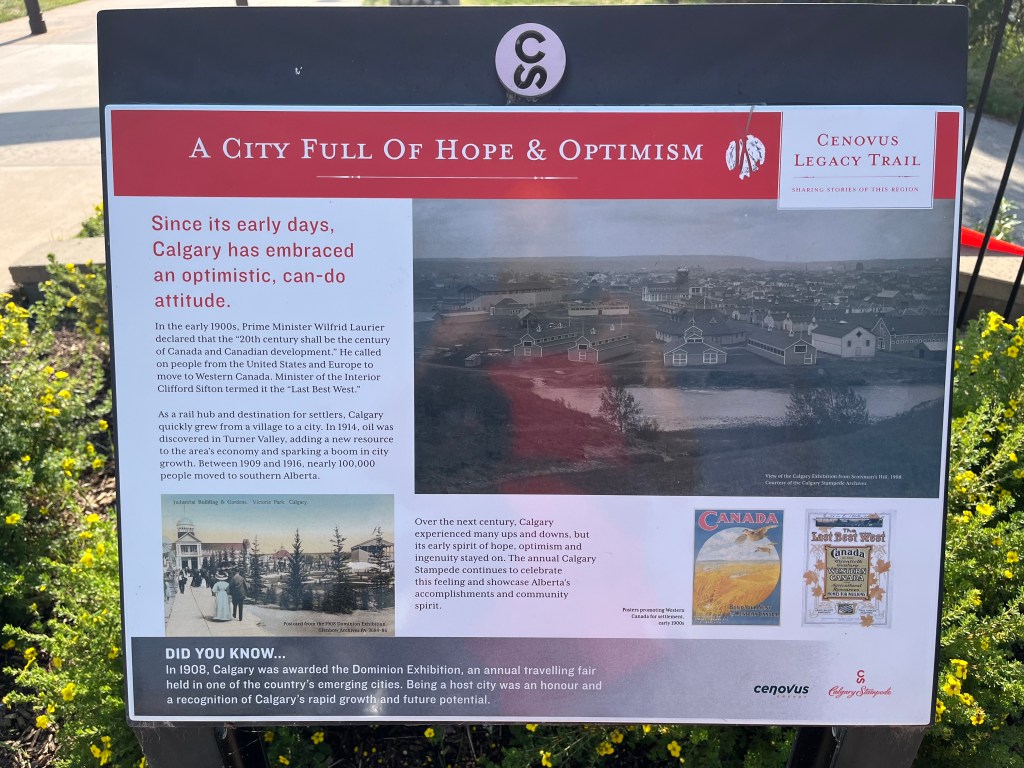
The first exhibition was held in 1886 to promote the town, encouraging farmers and ranchers to move west. In 1899, organizers purchased 38 hectares of land for exhibition grounds. This laid the foundation for the future of the Calgary Stampede.
The community was renamed Victoria Park after the reigning monarch. Queen Victoria encouraged exhibitions to bring people together in celebration. The legacy of the community as a place “Where Calgary Comes Together” will endure. There are plans to transform the area into a Culture and Entertainment District.
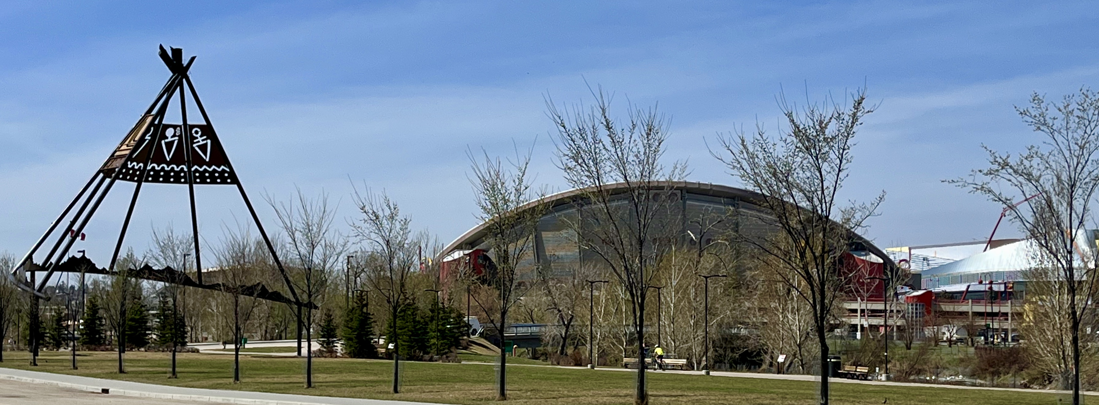
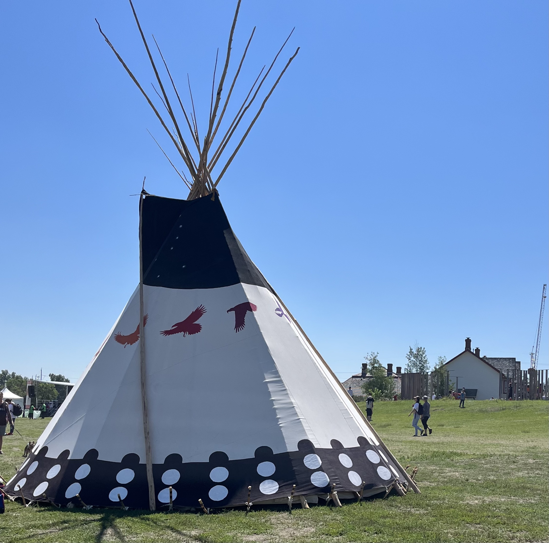
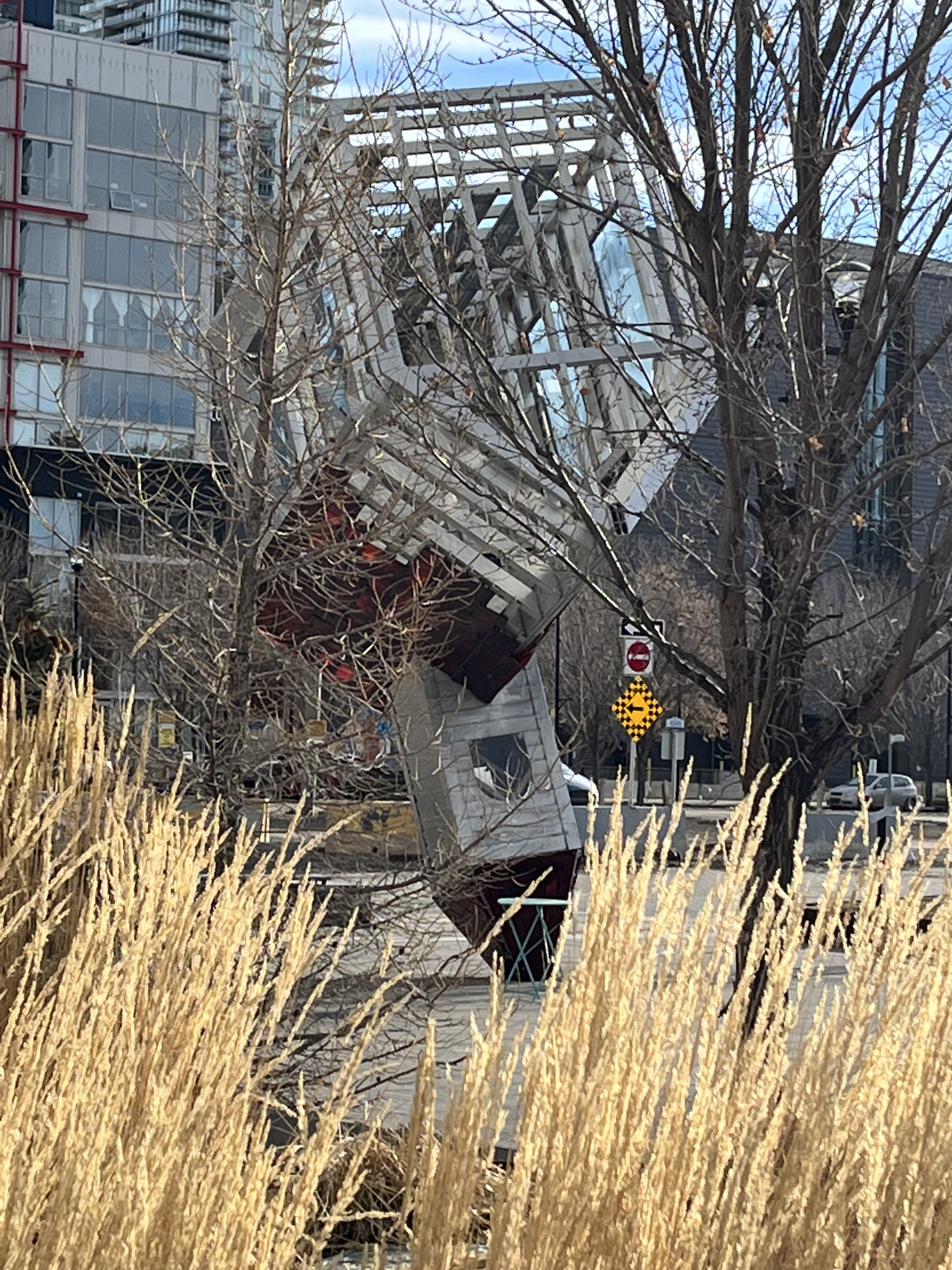
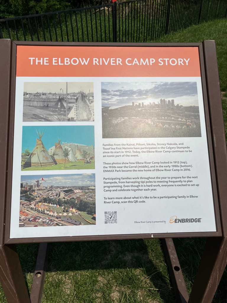
The semi-circle art installation called Tipi was unveiled at the Victoria Park Station entrance in 2012. The Calgary Stampede centennial year celebrated the relationship between First Nations families from Treaty 7 nations and the Calgary Stampede. It was relocated closer to Elbow River Camp in 2022.
Stampede Park
This space reflects how the local culture developed through its connection to the land. The Fairgrounds were renamed Stampede Park in 1901, adding new pavilions, plus a parade and rodeo in 1908.

The people of the Blackfoot nation were invited for the first time in 1912. That cultural contribution continues today. One of the best experiences is at the Elbow River Camp.
The Calgary Stampede has evolved into The Greatest Outdoor Show on Earth. Welcoming millions of visitors to the city to celebrate Western heritage, culture and community spirit.
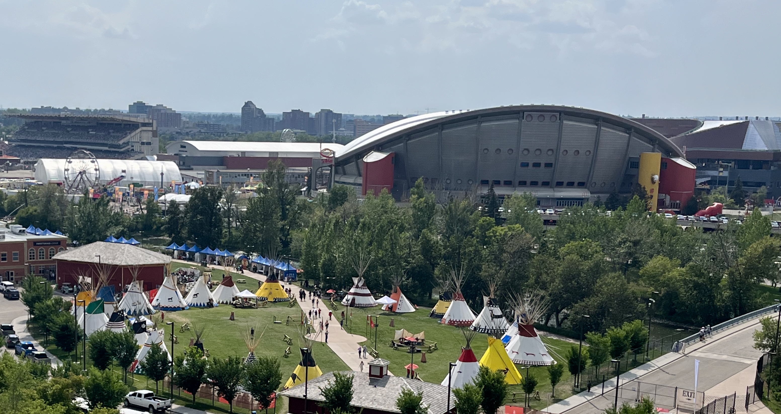
At the end of ENMAX Park is a bridge to explore the iconic Saddledome and Stampede Park. The plan to create a Culture & Entertainment District anchored by the new $1.22 billion Scotia Place will transform Victoria and Stampede Parks. The Saddledome appears destined for extinction in this evolving landscape. Explore this destination at Evolution of Stampede Park | Saddledome.
Follow the pathway along the east side of the river around Stampede Park to the South Entrance. Across the street is another destination – Reader Rock Garden.
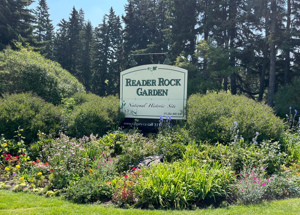
Explore an internationally praised garden and national historic site. It was an instrumental space for testing gardening principles and educating people about the horticultural potential of the area.
Mission
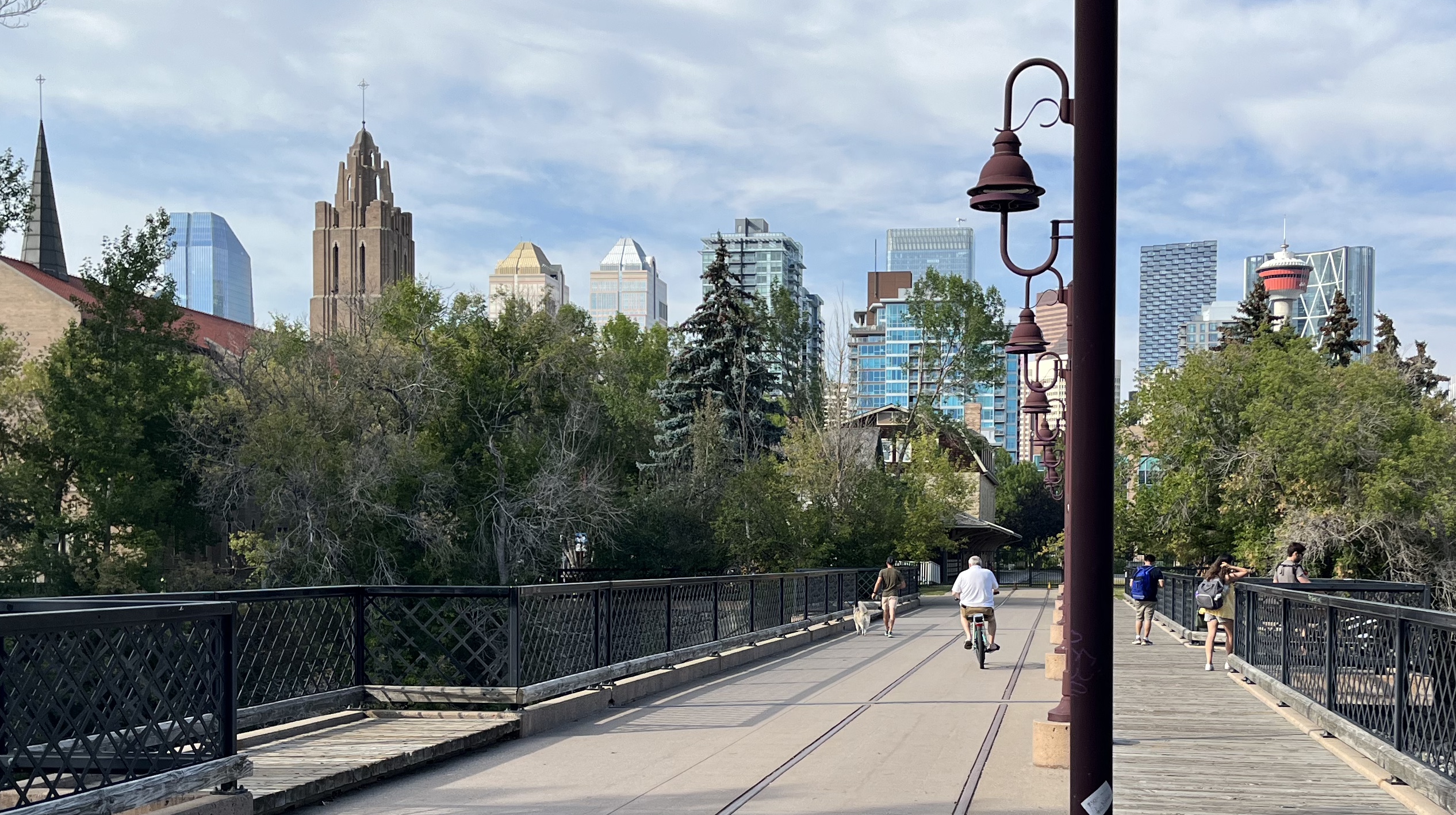
Heading west on the pathway, passing under Macleod Trail, you emerge surrounded by the urban forest of Lindsay Park. You will come across an awkwardly placed steel girder bridge.
Its scale hints at its history as an integral part of the Canadian Northern Railway line. A key contributor to the early economic prosperity of Calgary.
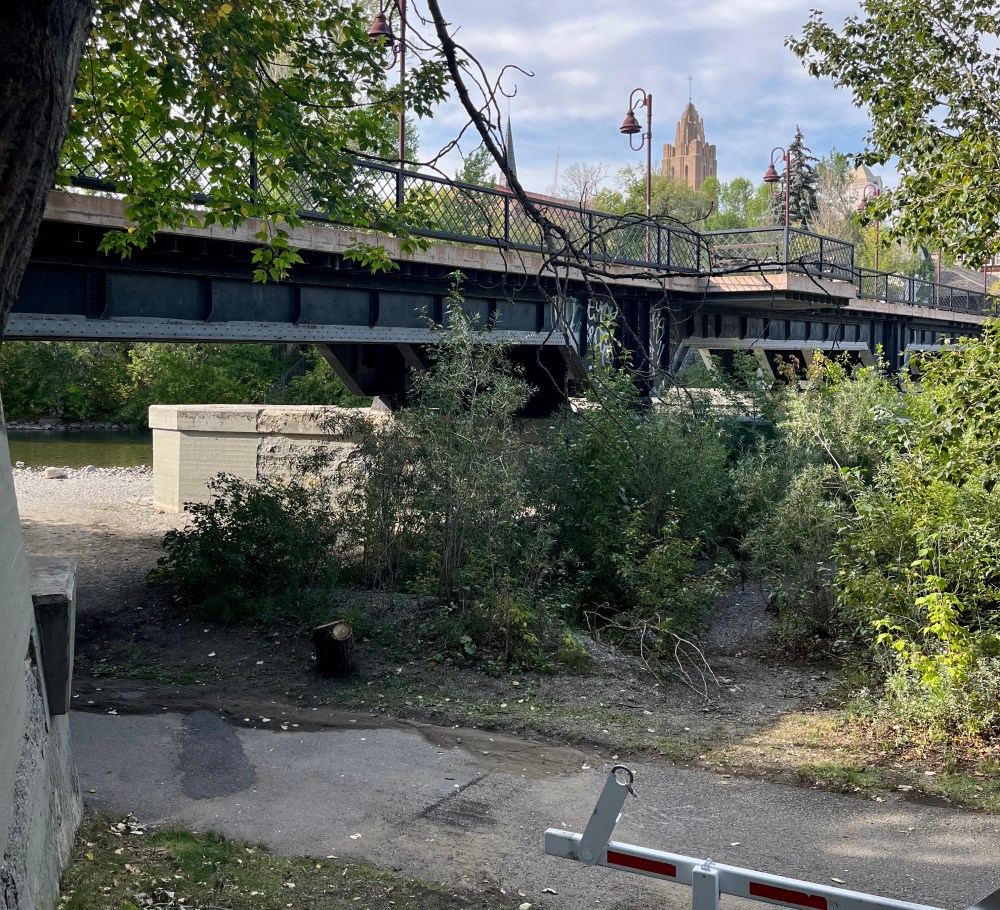
The bridge, built in 1913, was converted into a pedestrian bridge by the City in 1999. The stairs to the open deck reveal rail tracks and connect two landmarks to the park.
St. Mary’s Cathedral and Parish Hall serve as reminders. Before being annexed in 1907, the community of Mission was the French settlement of Rouleauville.
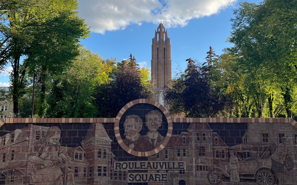
Built in 1905, the St. Mary’s Parish Hall was the center of the social and cultural life of the community.
It is an example of the Sandstone Building Legacy that further exemplifies the local connection to the land. The stone was abundant in Calgary and widely used after the fire of 1886 that ravaged the wood building stock.


The Canadian Northern Railway purchased it in 1911. They transformed it into a passenger rail station that operated from 1914 to 1971. The Calgary City Ballet moved into the building in 1982, returning it to a community hub.
Mohkinstsis Park
At the end of Lindsay Park, cross Scollen Bridge to a small green space. There is a plaque recognizing the First People at Mohkinstsis Park. At spots like this, you can find locals gathering along the rocky shores of the river.
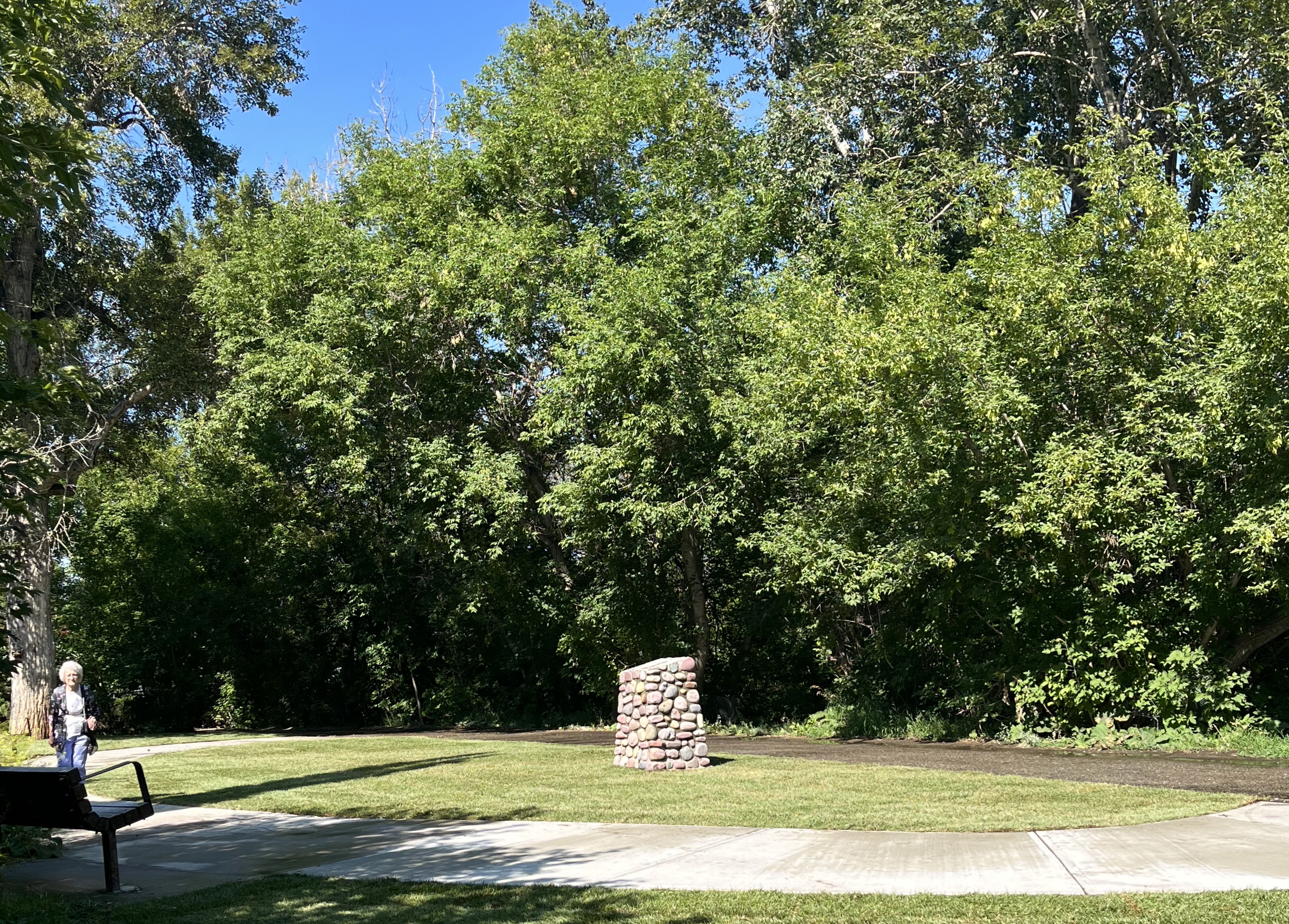

This watering hole provides the opportunity to paddle with ducks and pups with Roxboro off-leash dog park across the river. Head west on 26th Avenue to Mission Bridge. There is an outlook by the river, benches and access to Fourth Street.

Home to more than 300 businesses, public art and the annual Lilac festival attended by over 100,000 people this June.
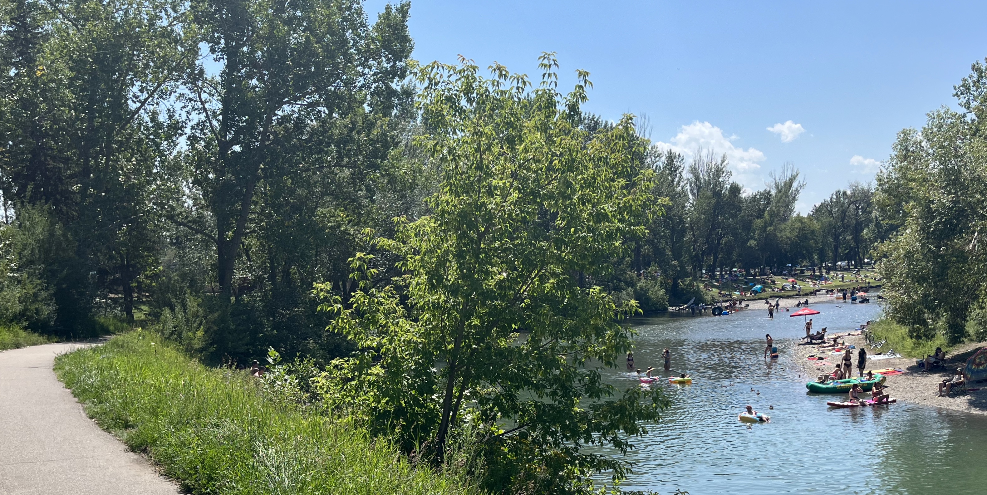
Stanley Park and Sandy Beach
Take the multi-use pathway along Elbow Drive and cross the bridge. Continuing briefly through the quiet community of Rideau Park until you arrive at another gathering place. The grassy slope in Stanley Park is a popular alternative for Calgarians looking to connect with the river.
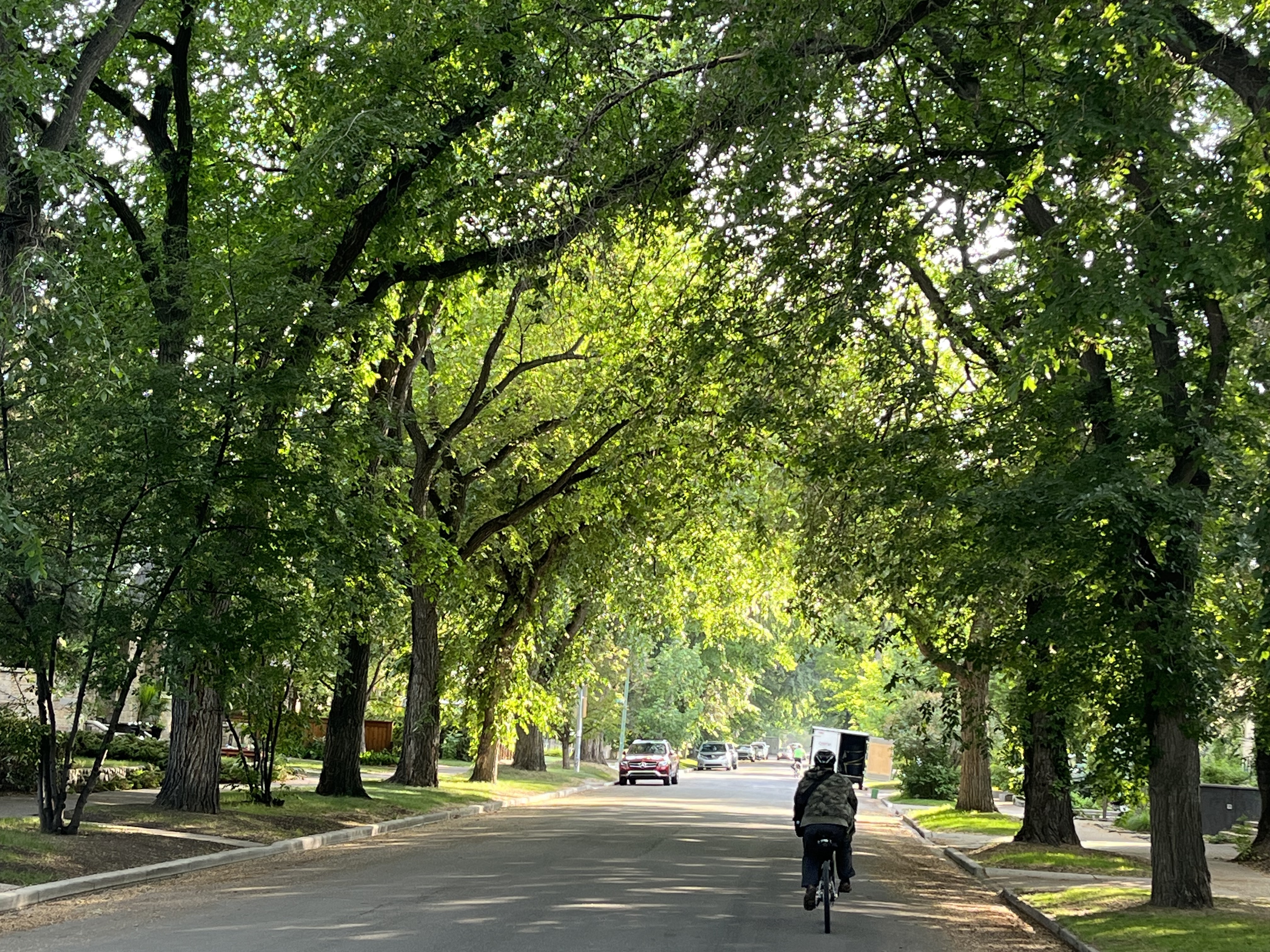
Follow the path under Elbow Drive until you arrive at Riverdale Avenue. Enjoy the canopy of mature American Elm as you briefly travel on a quiet residential street. Return to the pathway and reach the final destination before the Glenmore Dam.
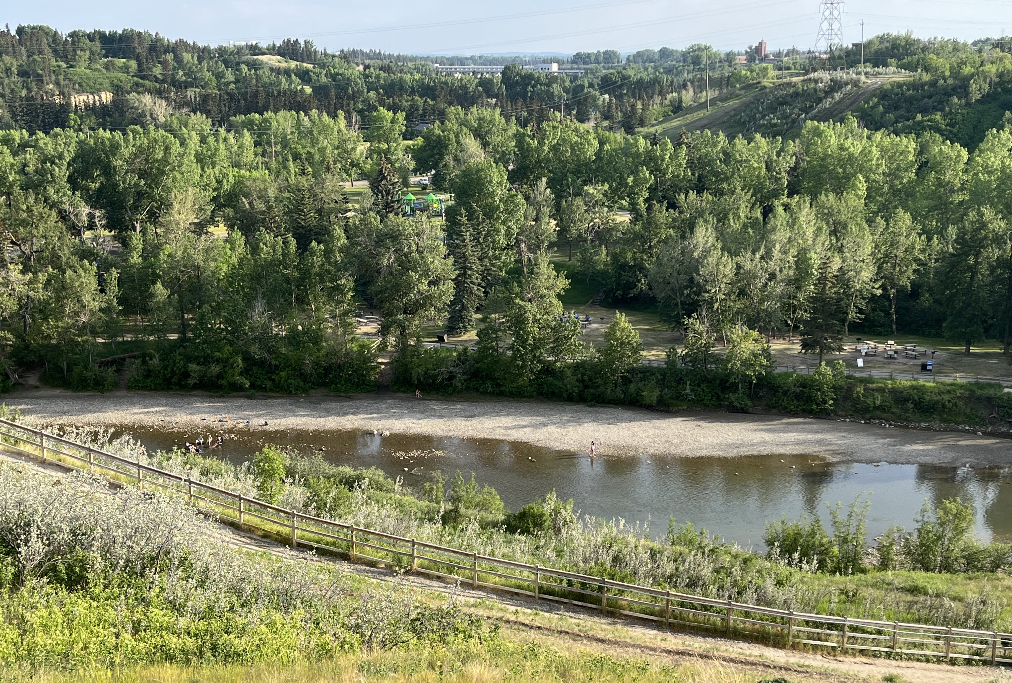
Despite the name, Sandy Beach has no beach, only another rocky shoreline. It does have plenty of green space for chilling, BBQs, and raft launching. It is also home to one of the best off-leash areas. Explore this destination at The Best Dog-Friendly Urban Hike.
On the other side of the Glenmore Dam is the Reservoir Loop. It is approximately 15 km of multi-use pathway. You can also check out Glenmore Reservoir – Recreation and Heritage Park. It features the Best Urban Trail for Fall.
ACKNOWLEDGMENT
This land is the traditional territory of the Blackfoot Confederacy, including the Siksika, Piikani, Amskapi Piikani, and Kainai Nations; the Dene of the Tsuut’ina Nation; the Îyârhe Nakoda of the Bearspaw, Chiniki, and Goodstoney Nations; and the Métis Nation of Alberta, Region 3.
For generations, many Indigenous groups and communities have celebrated their culture and heritage during the summer solstice. They do this to mark the significance of the longest day of the year. As part of the Celebrate Canada program, the government acknowledged this in 1996. They issued a Proclamation declaring June 21 of each year as National Aboriginal Day. In 2017, the day was renamed National Indigenous Peoples Day.
