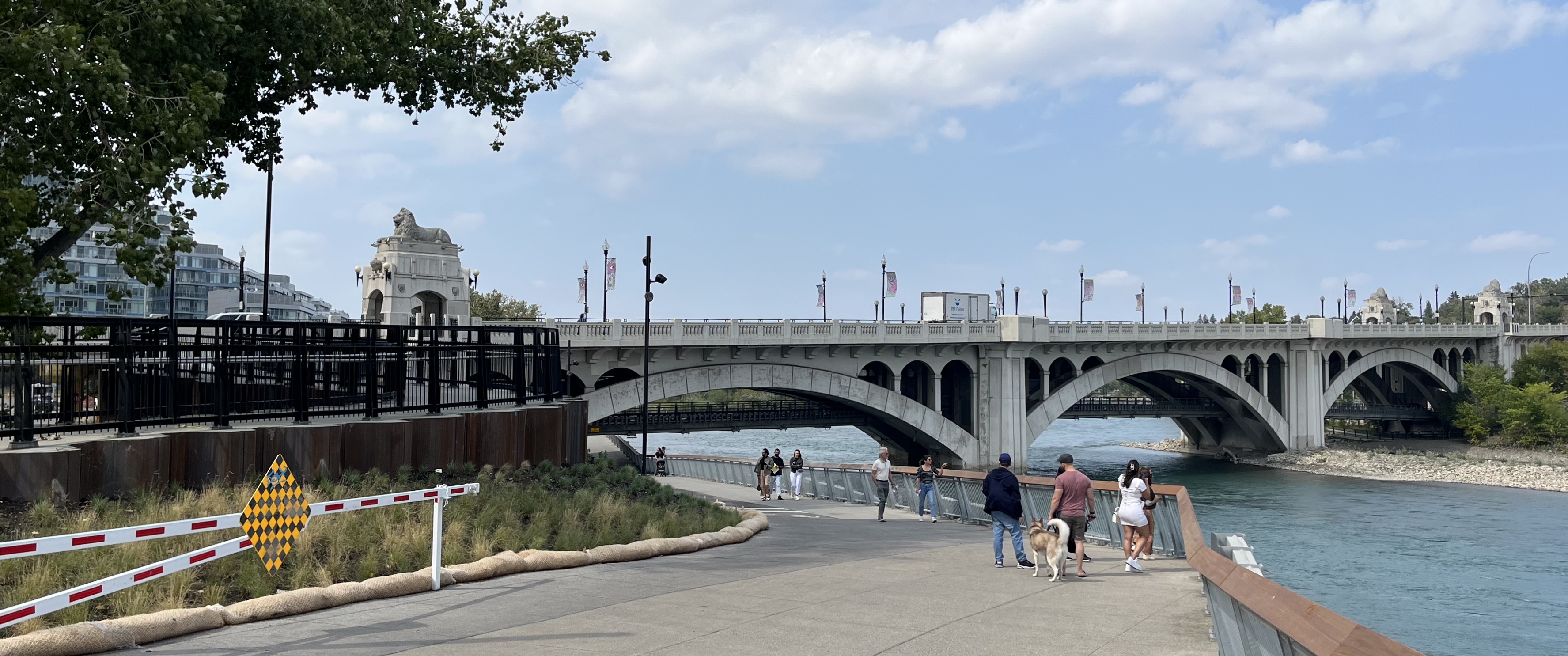
Centre Street Bridge is an iconic Calgary landmark and a historically vital transportation artery to the heart of the city.
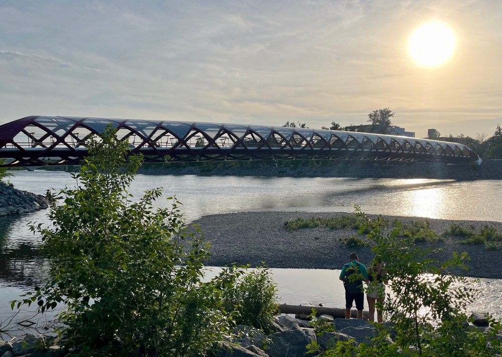
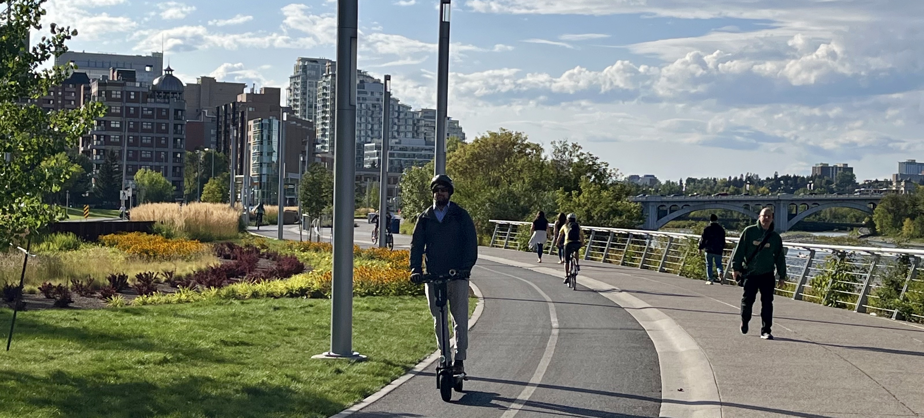
This destination on The City’s 900 km network of pathways includes the RiverWalk and the 29,000 km Trans Canada Trail. This system connects communities, people, and nature, making it a great place to explore on foot or by bike.
Centre Street Bridge is one of a few civic improvements aligned with the principles of the ‘City Beautiful’ planning efforts in Calgary. When it was completed it was considered one of the finest bridges in Western Canada. This was due to its monumental and decorative character.
City Beautiful Movement
The City Beautiful movement was a reform philosophy of North American architecture and urban planning that flourished during the 1890s and 1900s. The intent was to introduce beautification and monumental grandeur in cities.
Replacing the original bridge from 1907, it was instrumental to the early development of neighbourhoods north of the Bow River. But it was more than its utility that brought it acclaim when it was completed in 1916 for $370,000. Gracefully arched spans, classical balustrades, and cantilevered balconies contribute to the beauty of the reinforced concrete bridge.
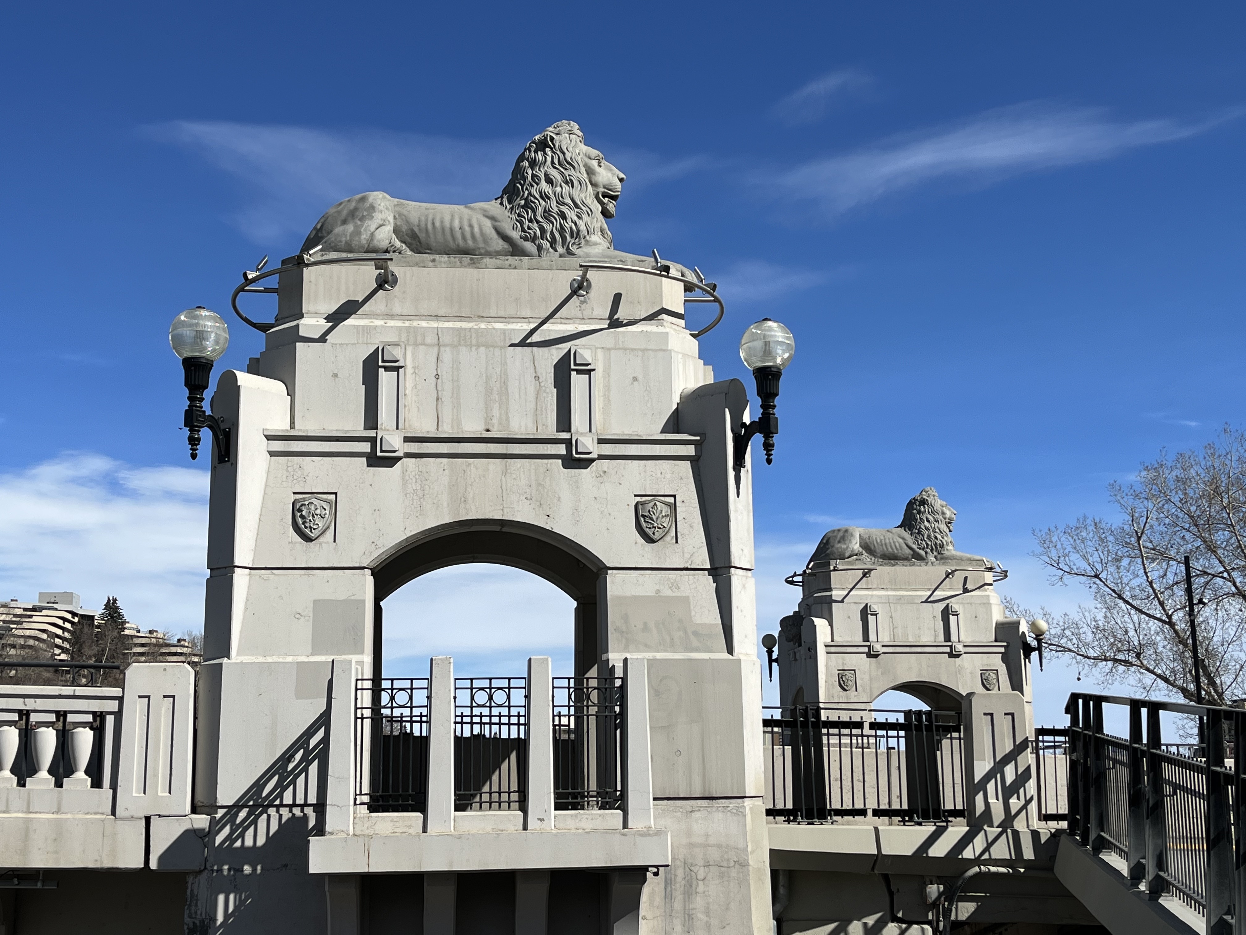
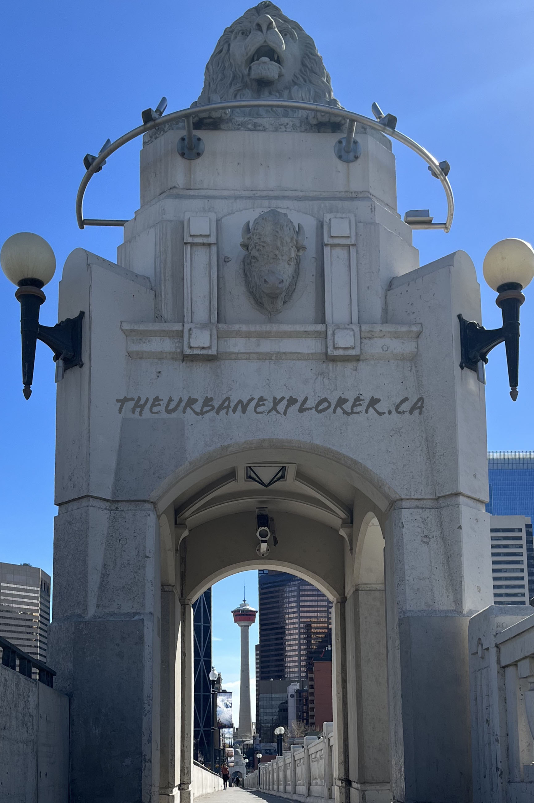
Paired kiosks stand at each end. They are decorated with symbolic shields that include buffalo heads representing Western Canada. Other symbols include a maple leaf for Canada. A rose represents England, a shamrock for Ireland and a thistle for Scotland.
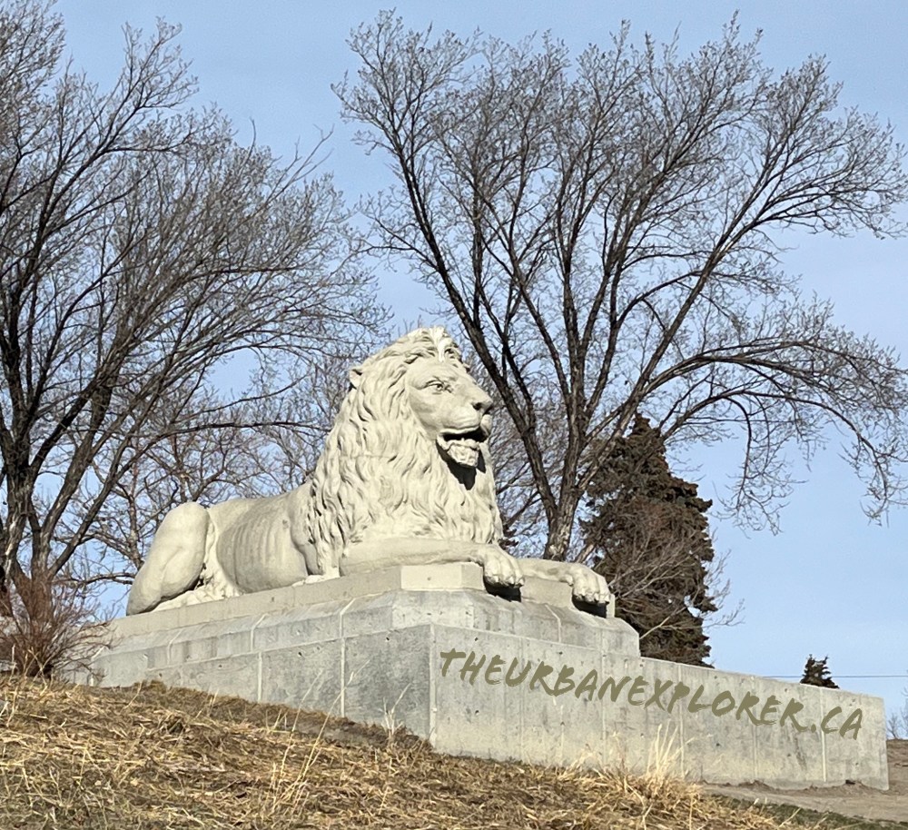
Two lion sculptures face north, and two more face south. They symbolize the British Empire and were designed by Scottish stone mason, James L. Thompson. He came to Calgary in 1910 and started working as a labourer for the City.
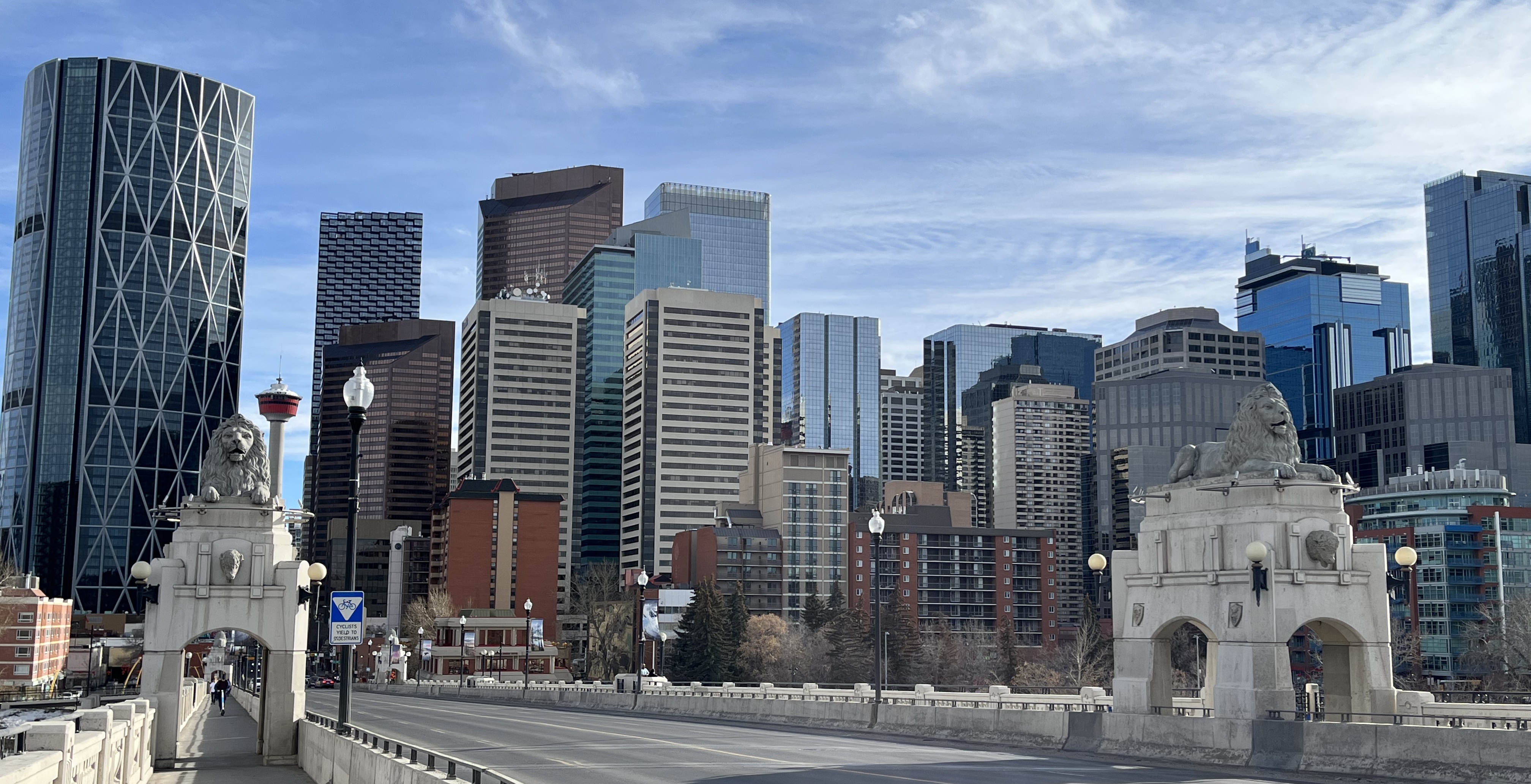
Thompson originally carved the lion for his garden as a hobby. It was inspired by those at the base of Admiral Nelson’s Monument in Trafalgar Square, London. This lion became the model for the bridge. They were cast on site, then hoisted and cemented into place. Thompson was later responsible for the sculptures adorning the Bow Bridge in Banff. (Credit HistoricPlaces.ca)
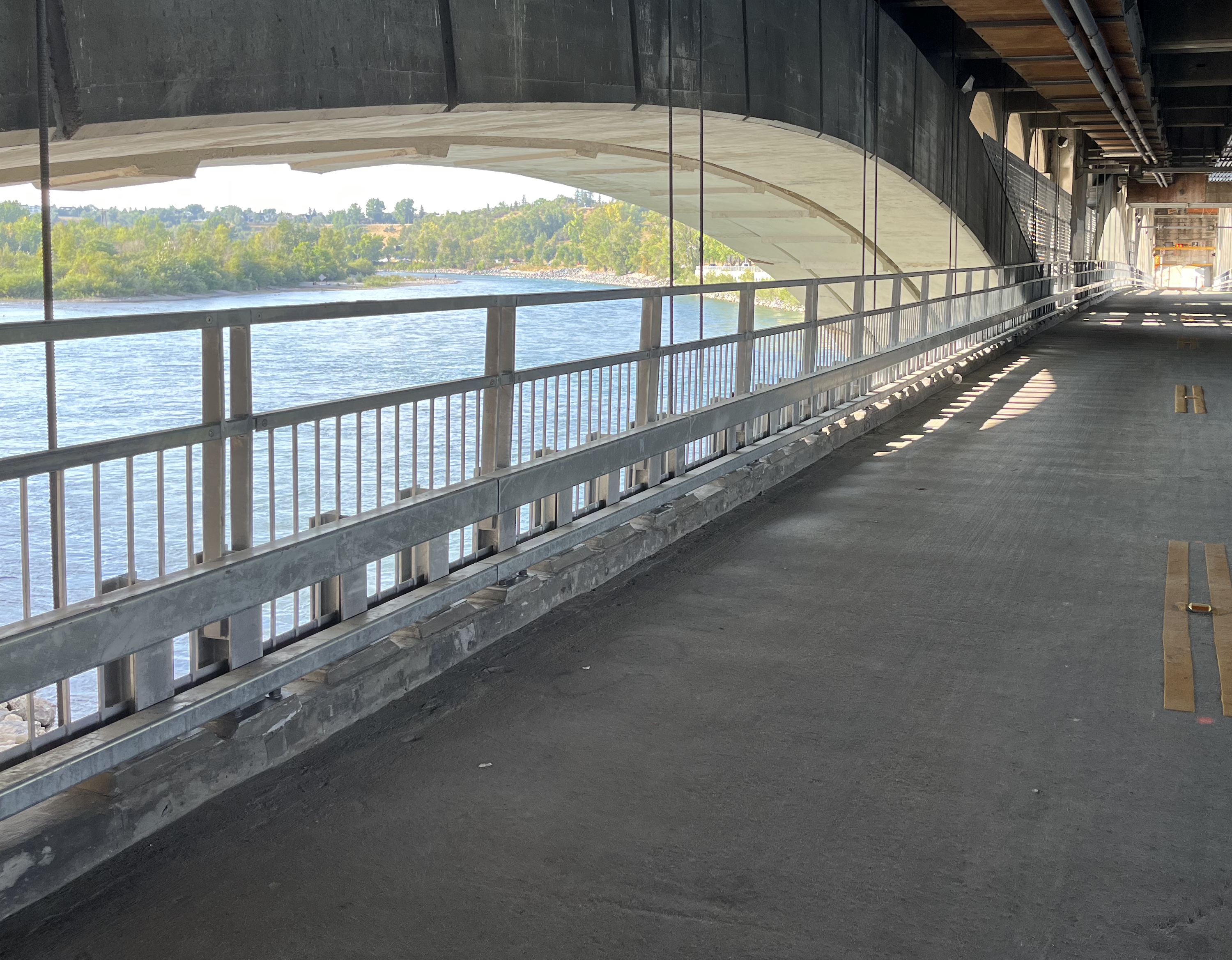
The lower deck was first designed as a pedestrian bridge and converted for traffic halfway through construction. For much of its early history, the bridge accommodated two streetcar lines plus automobile and pedestrian traffic.
In recent years, the lower deck has been utilized for pedestrian traffic during the summer. This change allows better access to the network of paths surrounding the area. The Downtown Flood Barrier, Eau Claire Promenade and other Area Improvements tie in upgraded pedestrian ramps that connect the bridge with the RiverWalk and Trans Canada Trail.
Trans Canada Trail
The Trans Canada Trail is the longest inter-connected network of multi-use recreational trails in the world. Spanning over 29,000 kilometres on land and water. It links three oceans and connects 900 municipalities.
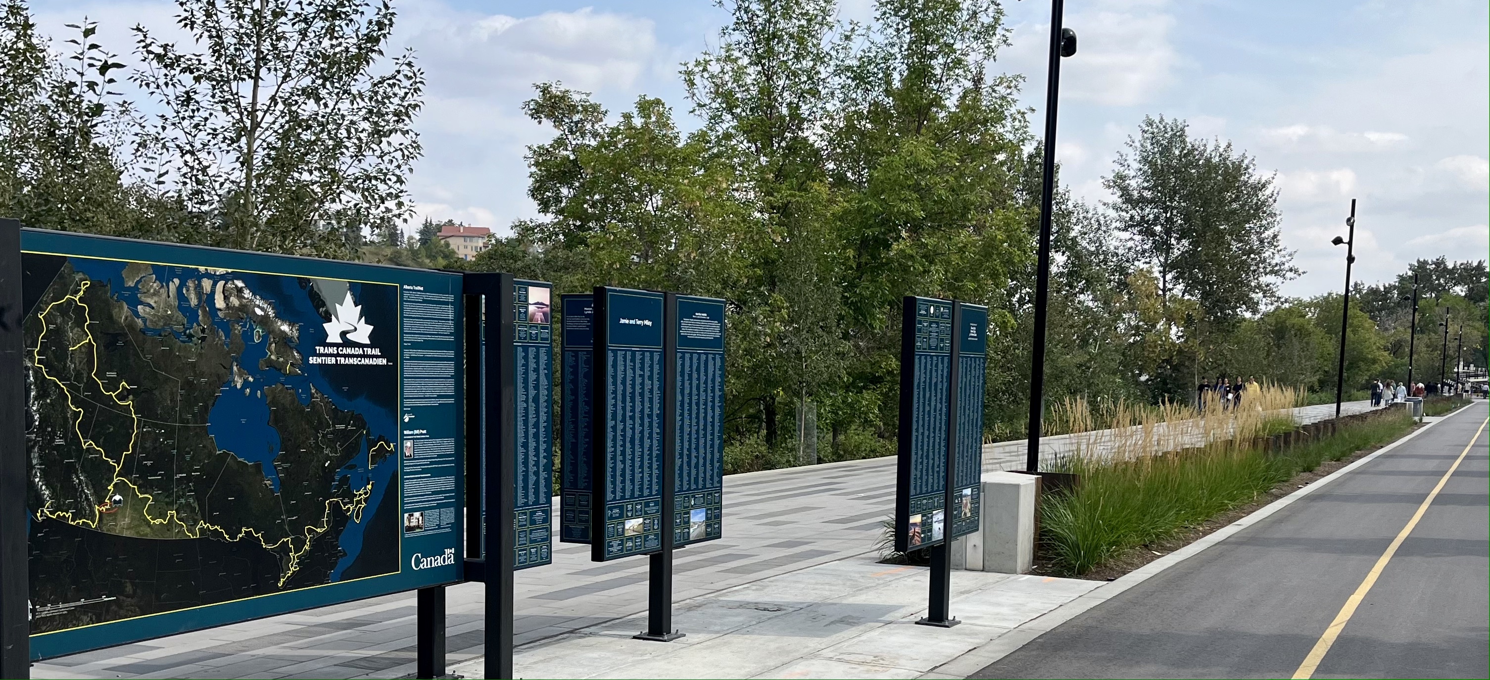
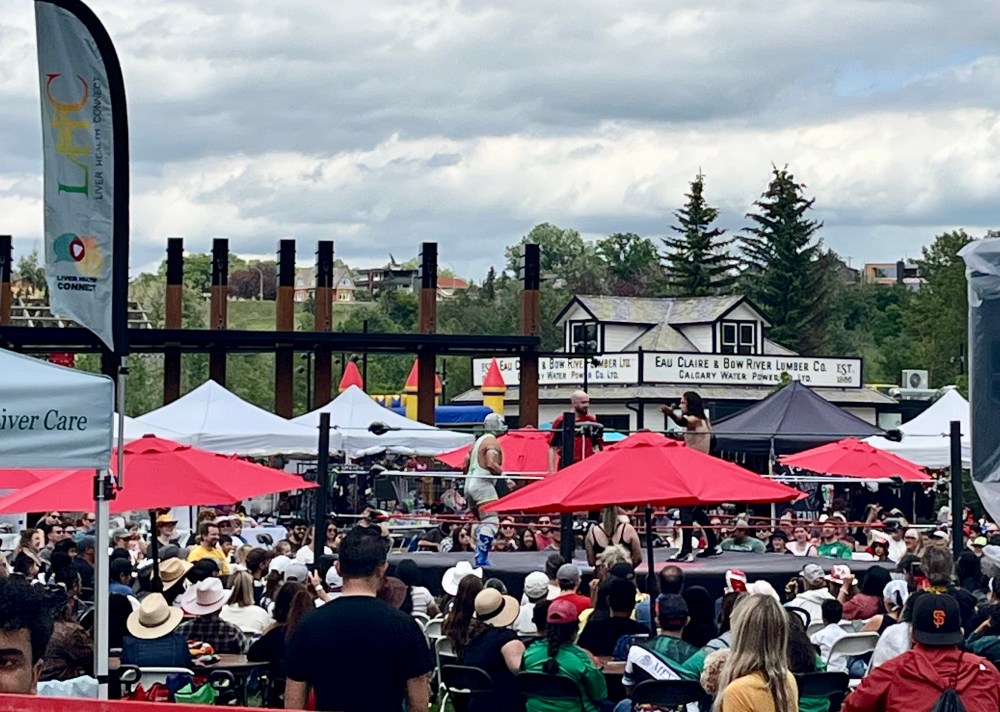
Supporting Canada’s national Trail, these donors shaped a world-class legacy that will outlast the steel of this pavilion – Trans Canada Trail website

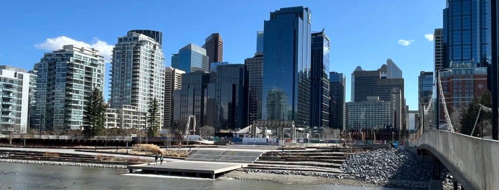
The RiverWalk integrates flood protection into a space that connects communities and Calgary’s downtown with the Bow River.
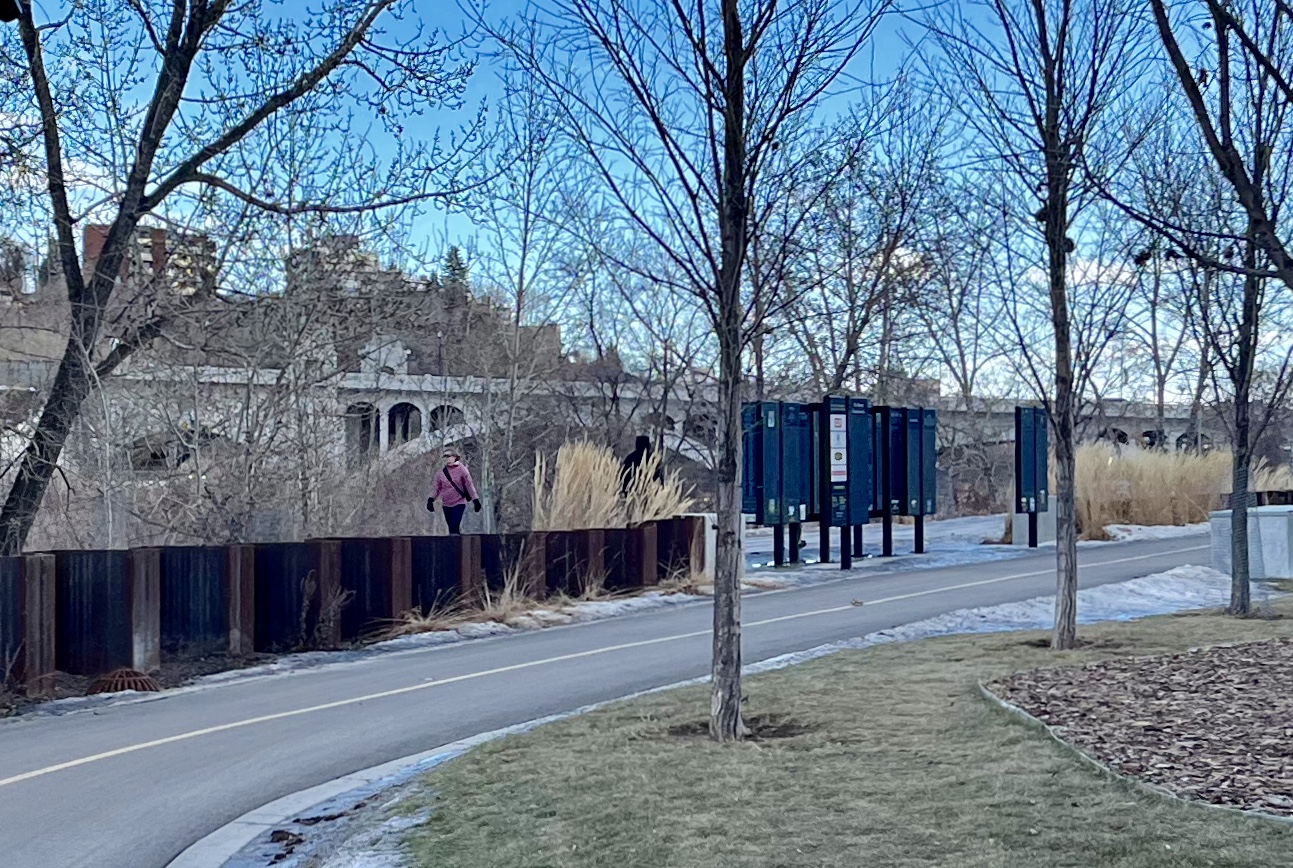
The City of Calgary maintains a system of 900 km of interconnected pathways. Part of this network runs along both sides of the Bow River. These paths offer pedestrians and cyclists a scenic way to explore Calgary’s natural beauty from a unique perspective.
Eau Claire and Prince’s Island
Construction on the north side pathway is ongoing. We recommend using the dedicated pedestrian and bike lanes on the south side of the river. If you head west, the Promenade extends to Peace Bridge and goes beyond West Eau Claire Park.
After nine months of planning, the jury unanimously picked the winner of the RiverWalk West design competition. Follow the link to learn more about The City’s plan to create a continuous promenade to West Downtown.
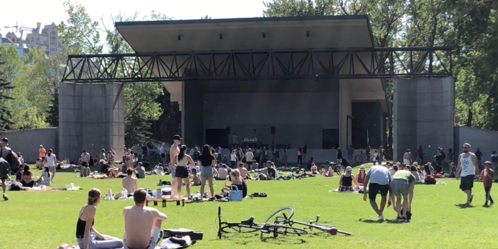
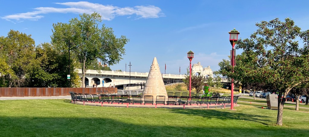
You can use the many bridges to create loops and explore both sides of the Bow River. Chill in Prince’s Island Park, a vibrant green space home to many festivals and events throughout the year.
Eau Claire Plaza officially opened on July 2, 2025. After four years The City celebrated the completion of the Eau Claire Plaza, Downtown Flood Barrier & Eau Claire Promenade, Centre Street Pedestrian Ramps, and Jaipur Bridge
Construction on the Eau Claire Area Improvements is ongoing, you can learn more here: Eau Claire Plaza.
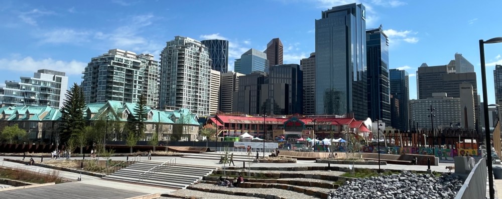
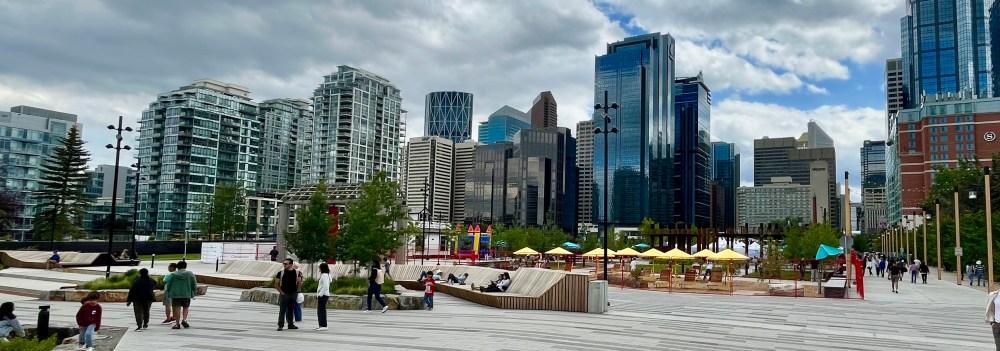
To support the long-term needs of the Green Line project, The City is continuing to invest in Eau Claire by installing a temporary green space next to Eau Claire Plaza. This will offer additional opportunities to gather, stay active and enjoy the downtown core. To learn more, visit The City of Calgary Eau Claire Temporary Green Space.
Riverwalk and East VILLAGE
Dedicated pedestrian and bike lanes continue to the east for approximately 1.6 km from Centre Street Bridge to 9th Avenue SE. Scenic views and manicured, natural landscape make the RiverWalk a destination while encouraging active methods of transport.
Explore the East Village and Fort Calgary. This area is historically significant. It served as a gathering place long before settlers arrived. To learn more, click Mohkinstsis – Where Calgary Comes Together. Get the map with areas of interest along the 9 km journey on the Elbow River Pathway.
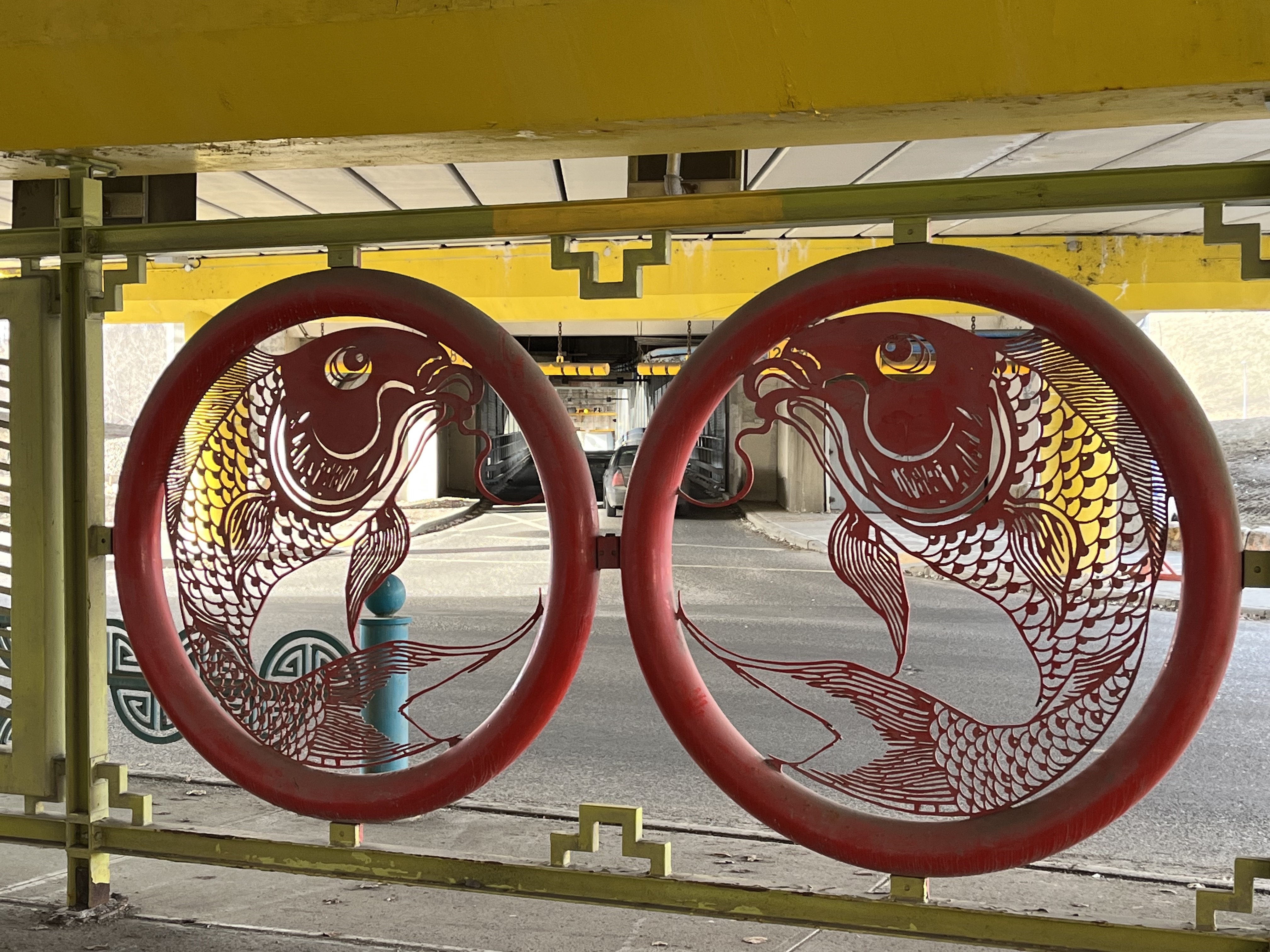
Chinatown and CITY Centre
Beside the bridge is Chinatown’s lone green space, Sein Lok Park. Embodying the motto behind the name that “happiness comes through good works”. The Sien Lok Society of Calgary, in co-operation with the community, created the space in 1982.
It features a sculpture titled “In Search of Gold Mountain” by Chu Honsun. Made from 15 tonnes of granite from Hopei Province in China to honour the Chinese history within Canada.
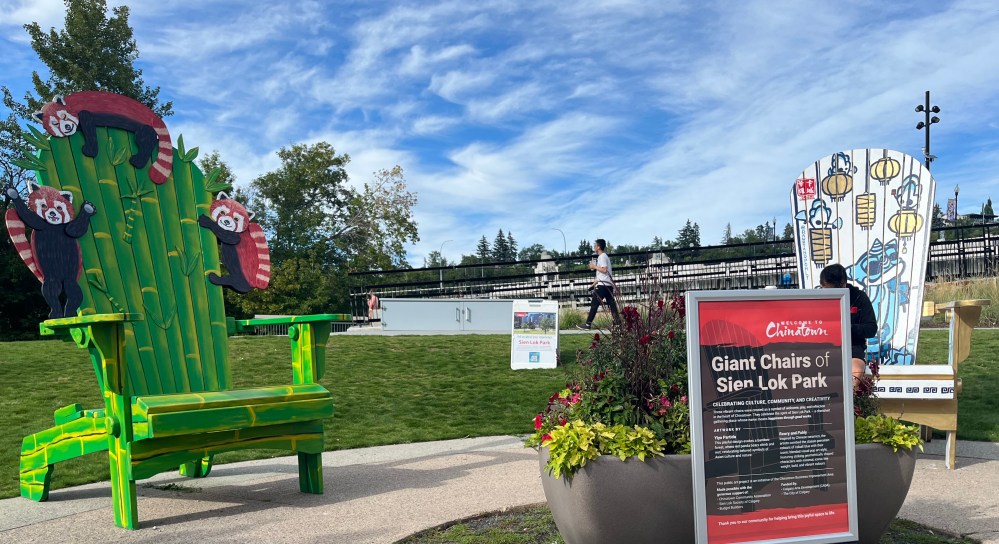
August 2025 also saw the installation of 2 new gigantic Adirondack chairs.
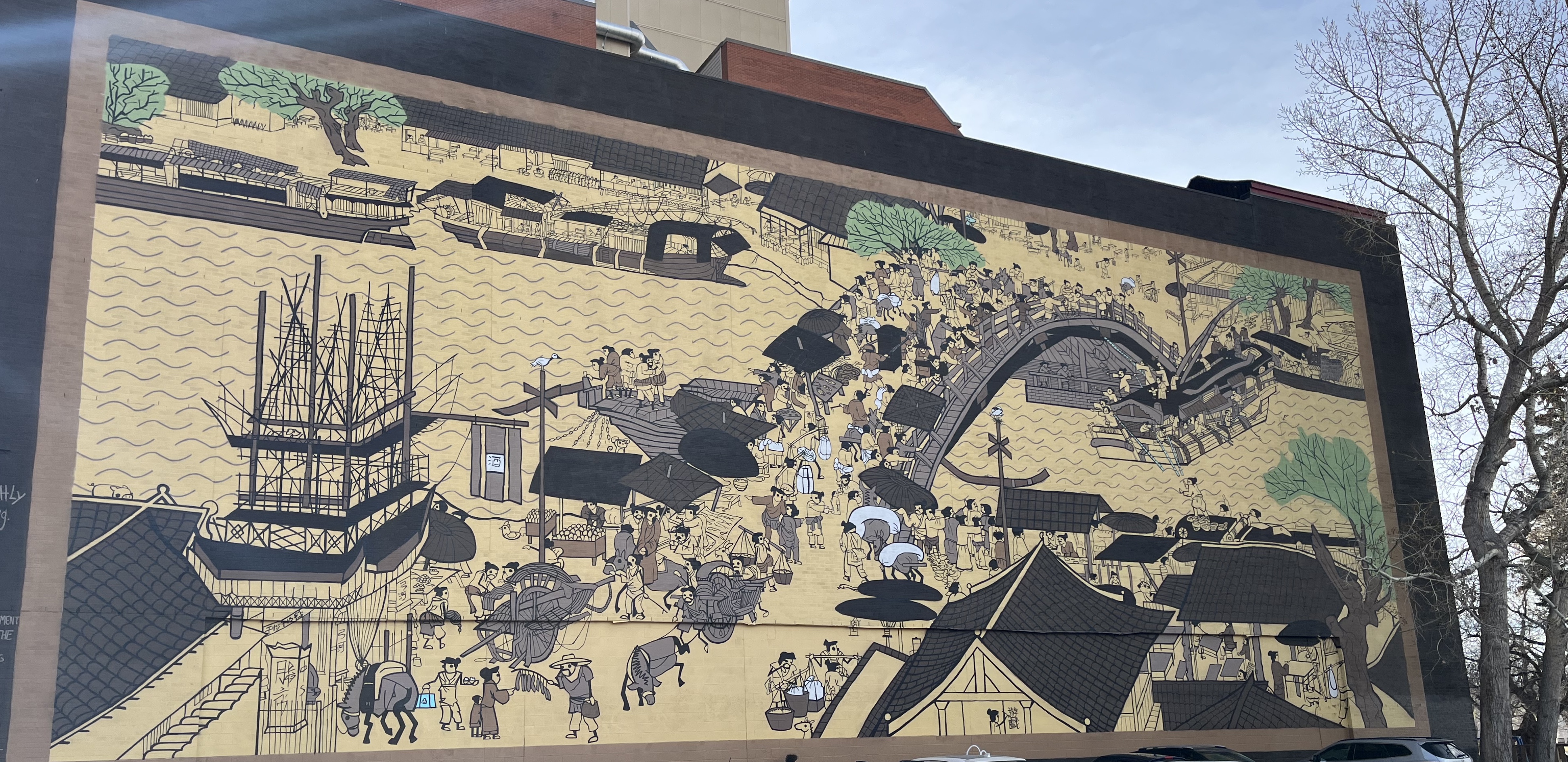
South of the bridge is Chinatown. If you look west from the bottom of the bridge, you will see a mural.
The public art installation was created by Artists Jamie Mason and Kevin Chow. It is based on a hand-scroll painting titled Along the River During the Qingming Festival (Qingming Shanghe Tu).
Many consider the original work to be the most outstanding work of art from the Song dynasty. It was painted initially by Zhang Zeduan (1085–1145).
There are other areas of interest and urban lookouts further south on Centre Street that connect you to the downtown core. Click on the links for feature posts from The Urban Explorer about these destinations:
- Wonderland – The Tallest Buildings
- Behind Stephen Avenue
- Calgary Tower – Exploring An 802-Step Art Gallery
Centre Street Lions
Centre Street Bridge and its lions were designated a Municipal Historic Resource in 1992. The lions were also added to the Public Art Collection the following year.
Time took a toll on these imposing pieces of art. The exposure to Calgary’s freeze-thaw cycles and the vibrations of the traffic on the bridge caused them to deteriorate. Efforts to preserve the original lions and the bridge have been extensive. Significant repairs were made during the 1970s and 80s to extend their life.
In 1999, the bridge was closed for major renovations. The lions were assessed in 2000. The City Council decided to remove and repair the sculptures. The best-preserved lions were used to recast four new lions for installation on the bridge.
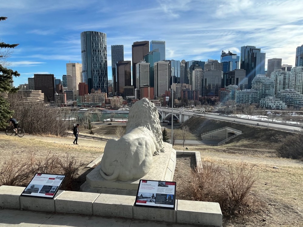
One of the restored lions was moved north, to a new perch in 2018. It overlooks the bridge in Rotary Park at 617 1st Street NE. The park offers a view of the Calgary skyline. It features a spray park, playground area, seasonal water fountains, and washrooms. There is an off-leash area to include your furry friend, or you can explore The Best Dog-Friendly Urban Hike.

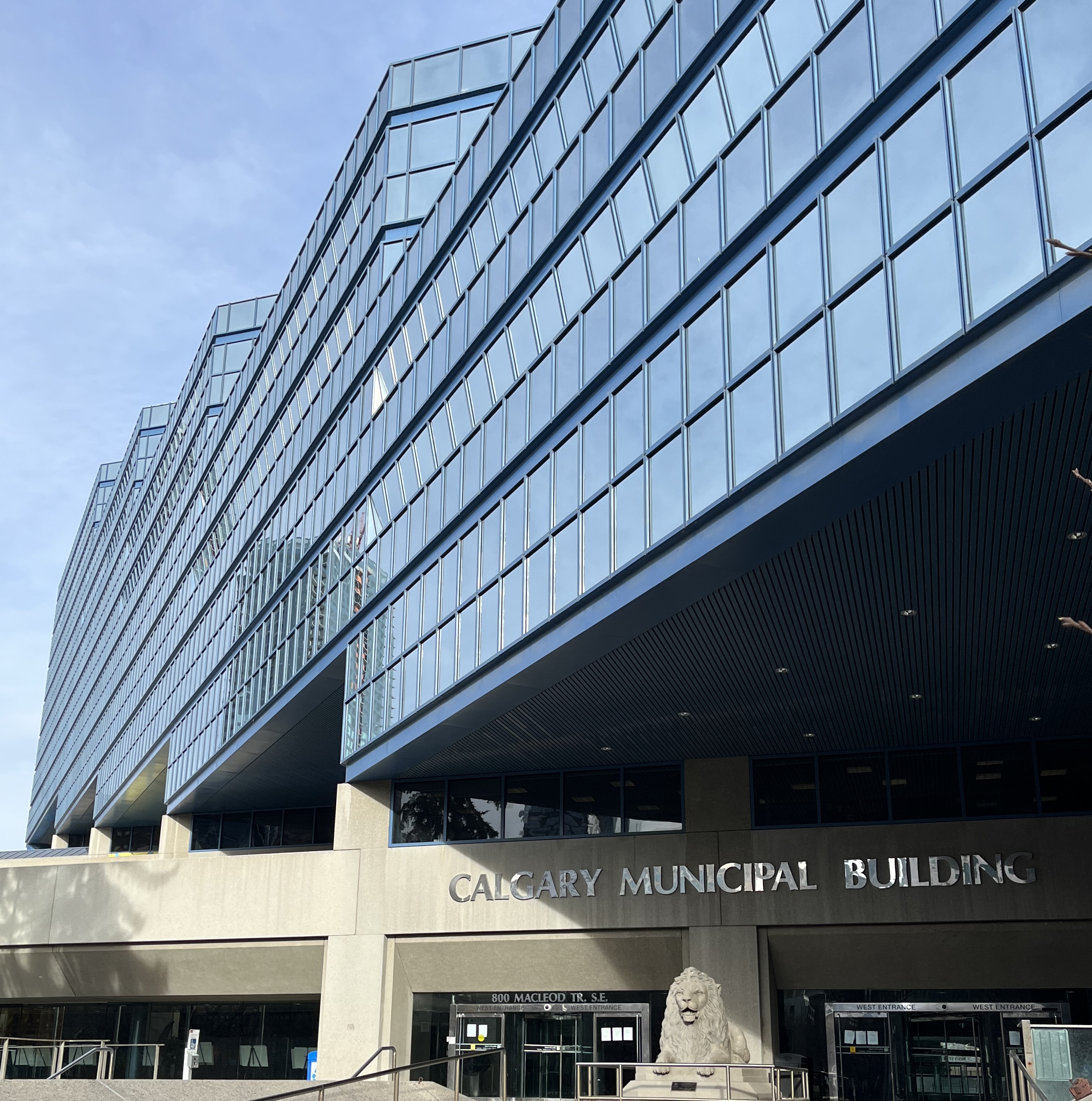
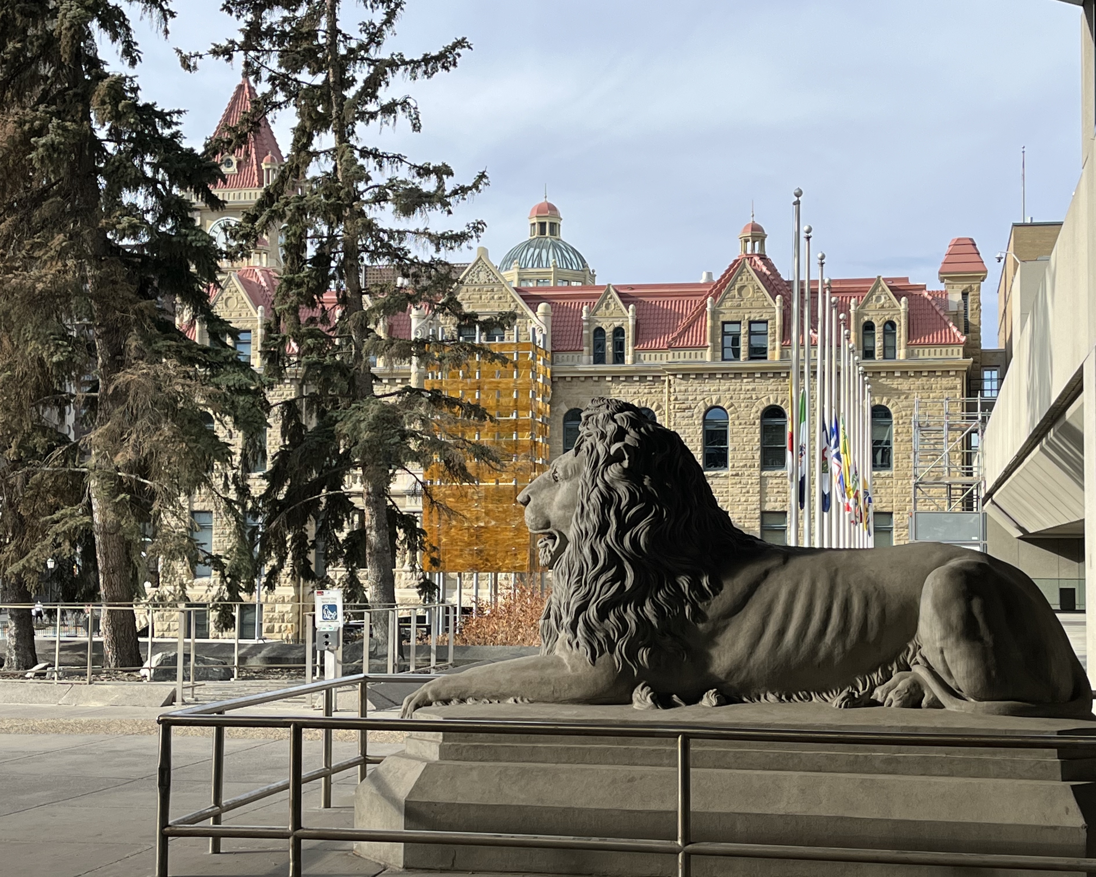
In 2003, the fully restored original lion was placed at the entrance outside the Municipal Building. It was used as a mould for the new bridge pieces. The remaining two lions are in storage to protect and preserve them for the foreseeable future.
Next Steps – Where to Go From Here
City Hall is a great starting point to explore Stephen Avenue. It is one of only three National Historic Districts in Western Canada. Across the street is Arts Commons, with the Reimagined Glenbow transformation happening on the next block.
