Explore the historic residential community of Mount Royal with the retail and entertainment district along 17th Avenue and 4th Street.
This urban hike should take approximately 1 hour and 15 minutes. It features lookouts of the city skyline, green space, heritage buildings, public art, and urban design.
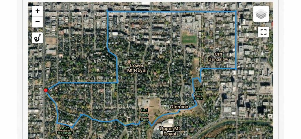
There is a mix of elevations that can raise your heart rate. The diverse terrains range from concrete sidewalks to trails and wooden stairs.
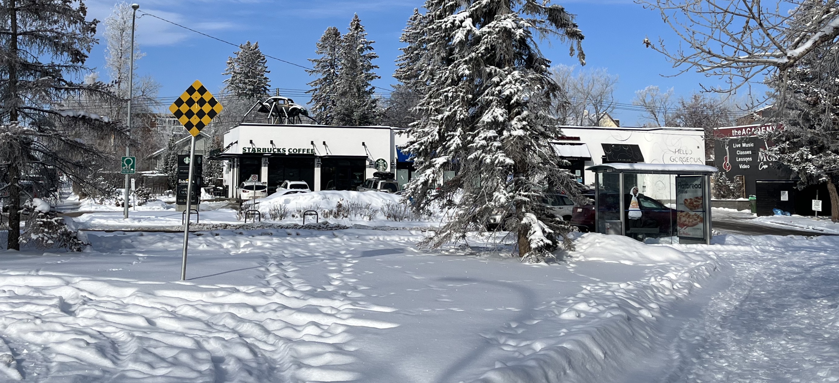
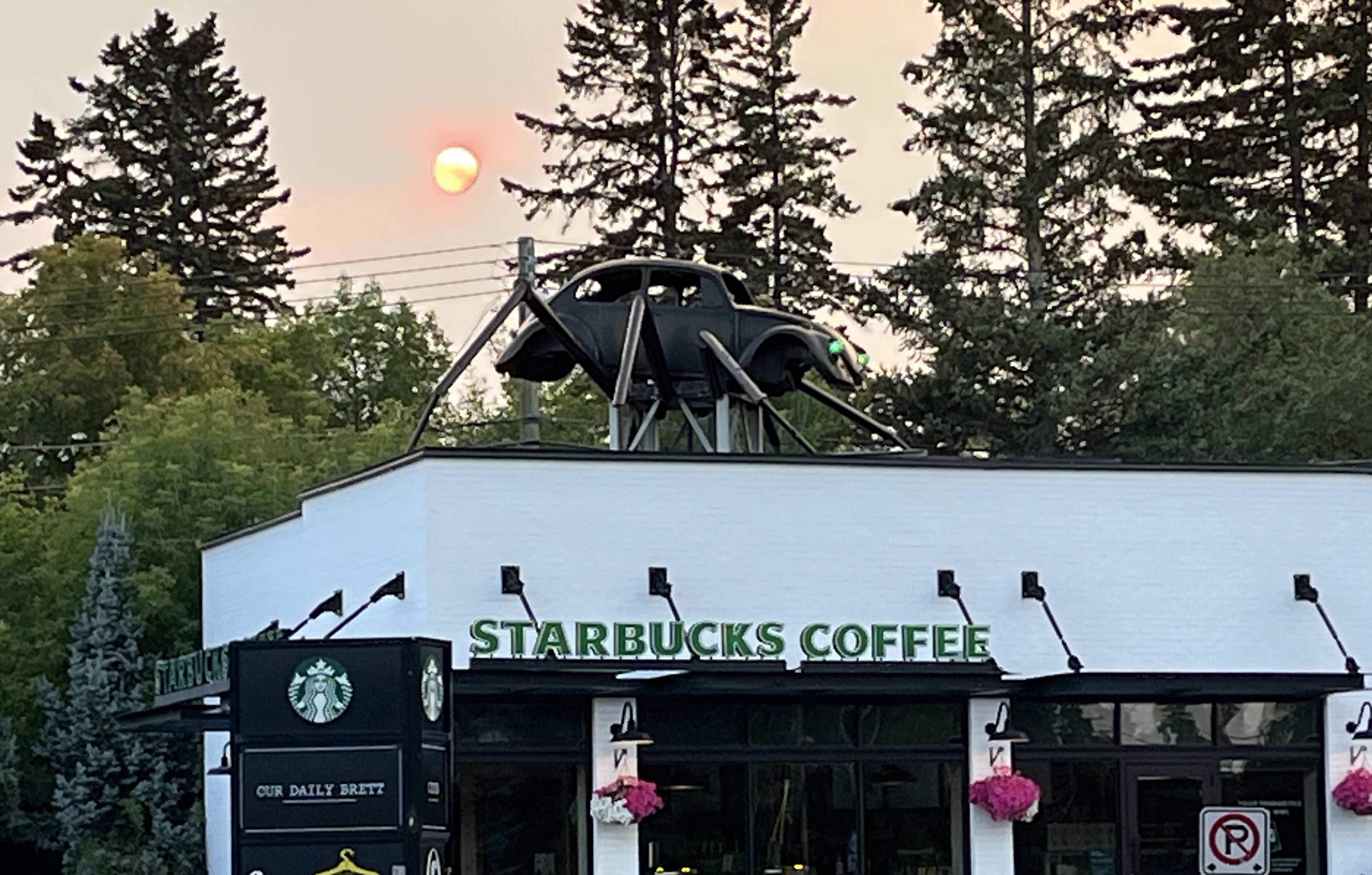
Starting Point – Artsy Arachnid
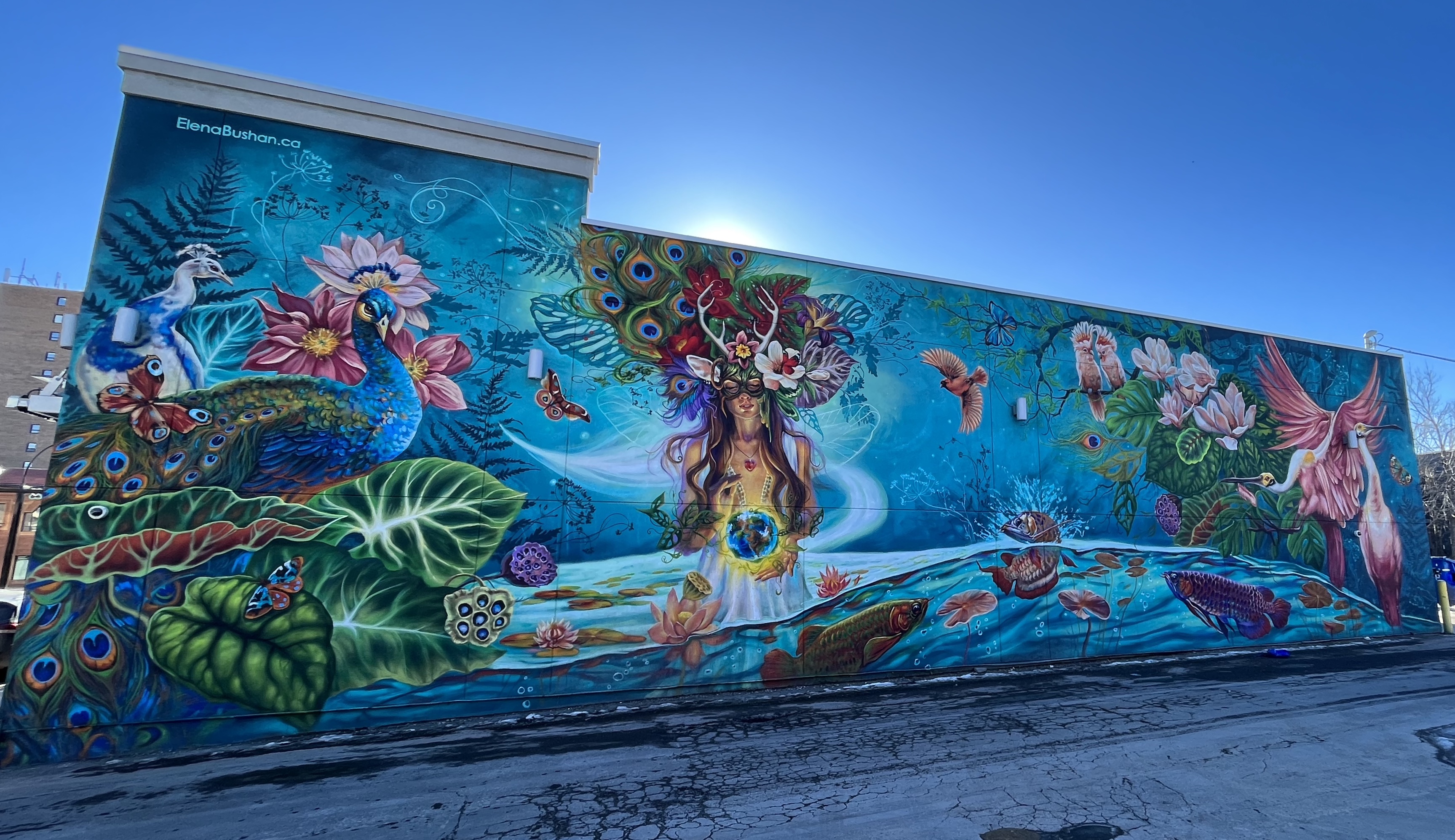
This iconic piece of Calgary public art had been in front of The Mechanics on 30 Ave for three decades. Dubbed the Artsy Arachnid by Livewire Calgary, it is now a significant part of the city’s cultural landscape. It was relocated for area redevelopment and reinstalled on the roof of the Starbucks at 2513 – 14 Street SW.
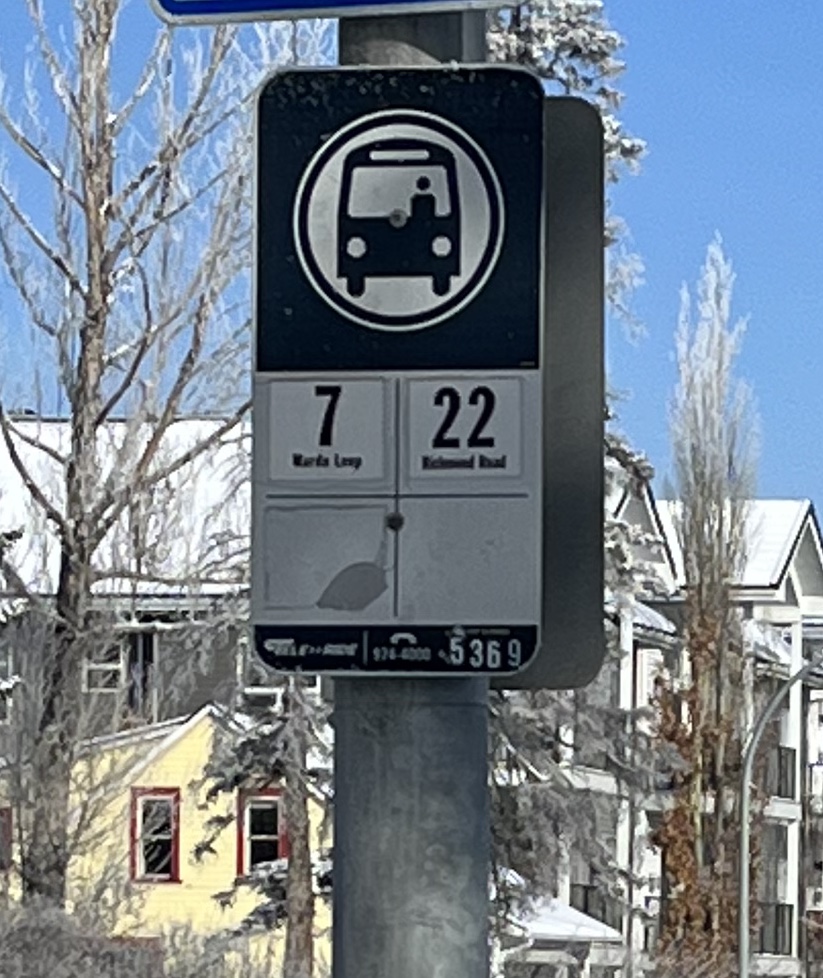
Using the bus stop across the street as the starting point. Start by heading east on Prospect Avenue. You will finish the 5 km loop at the end of Wolfe Street and Frontenac Avenue.
IMPACT OF THE CANADIAN PACIFIC RAILWAY ON THE URBAN LANDSCAPE
In the 1880s, the Canadian Pacific Railway (CPR) made an agreement with the federal government. As an incentive to build the transcontinental railway, the CPR received 25 million acres of land in western Canada.
The company would decide the location and design of town sites. It imposed a grid configuration on plans with uniform lots. The development of the residential subdivisions in the southwest part of Calgary was an exception.
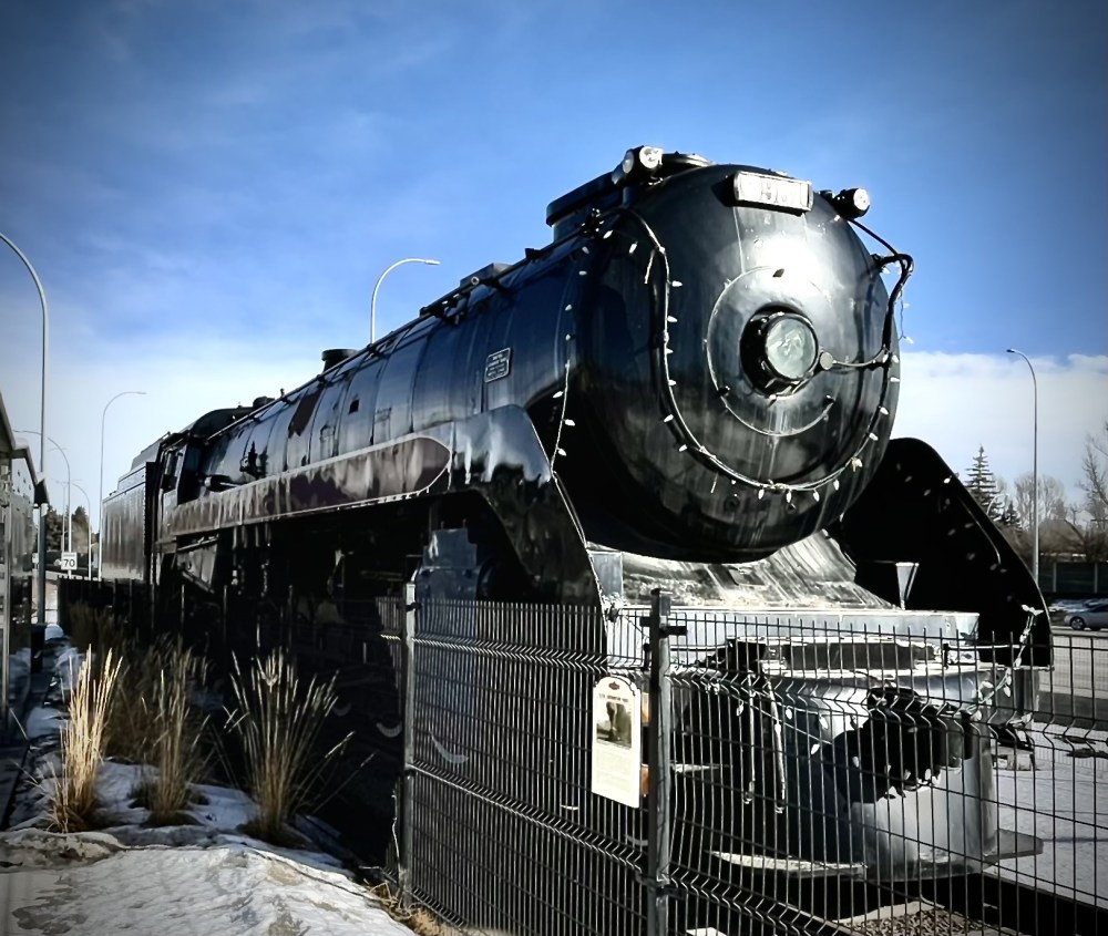
Learn more about how the CPR influenced Calgary’s growth as an urban centre. Visit the public art installation located across the street from the original station at Emergent – Towers. If you are exploring the city by bike, you can see the train in the picture. There is also a replica of the train station at Glenmore Reservoir – Recreation and Heritage Park.
Exploring Mount Royal
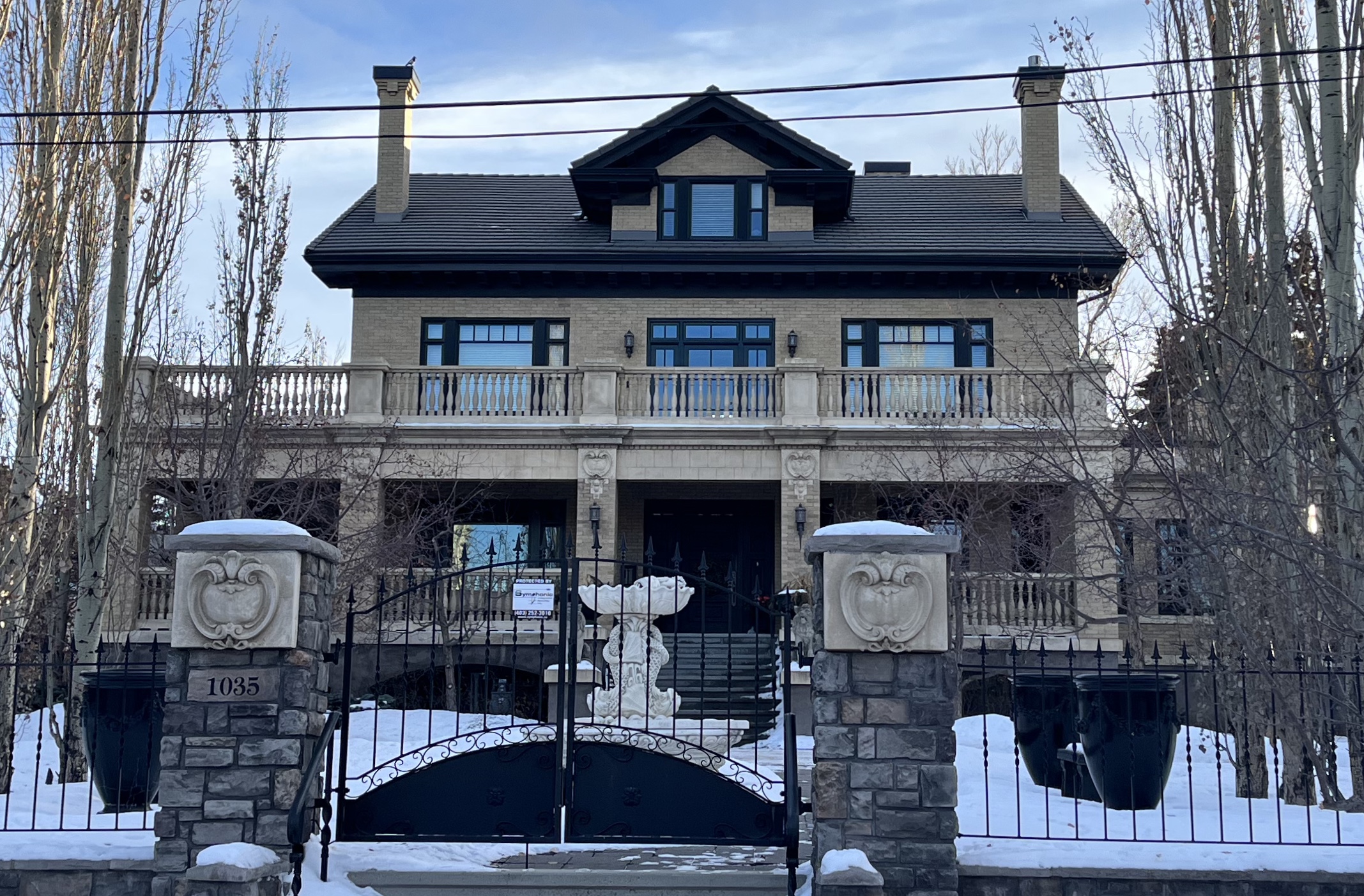
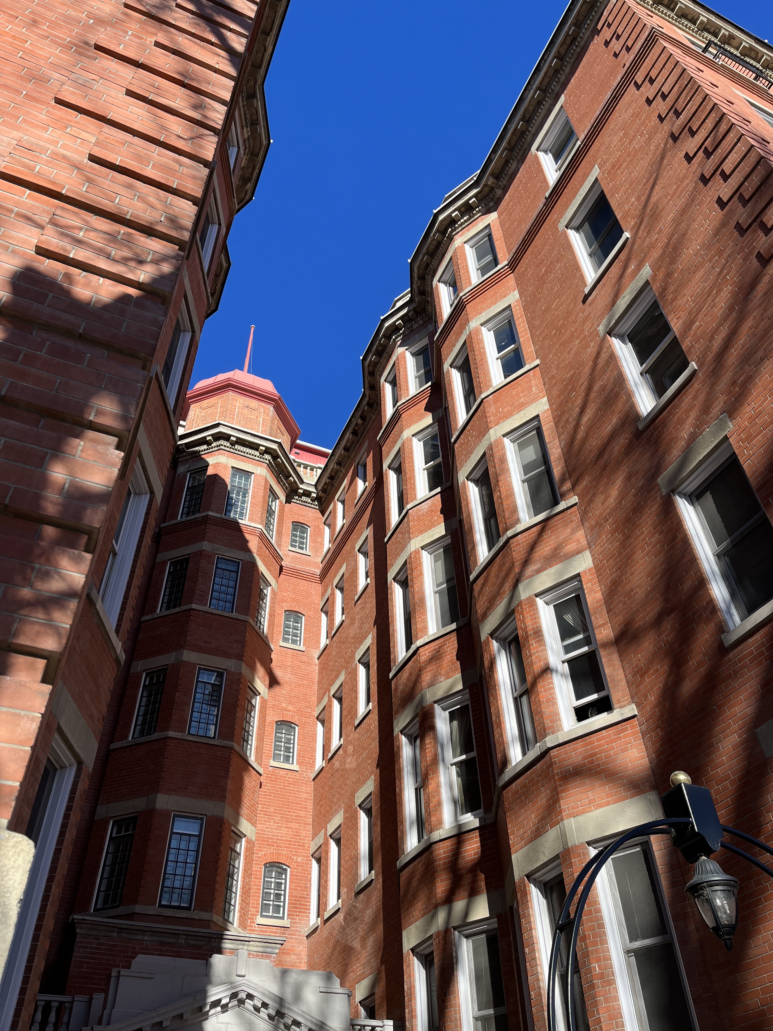
The community was conceived as an elite residential area. Caveats were placed on properties. These architectural controls ensured a prestigious standard of living. To learn more about Restrictive Covenants, visit the Mount Royal Community Association website. There, you can learn how they are used to protect this historic community today.
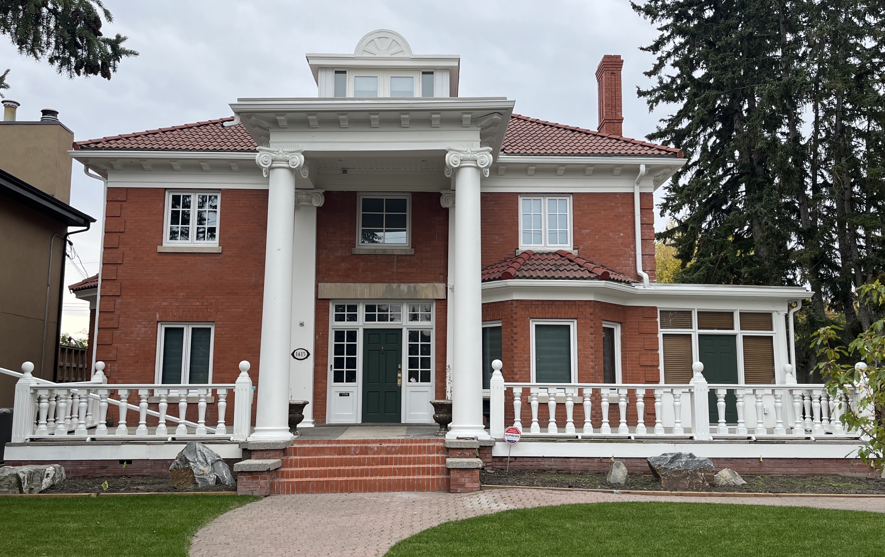
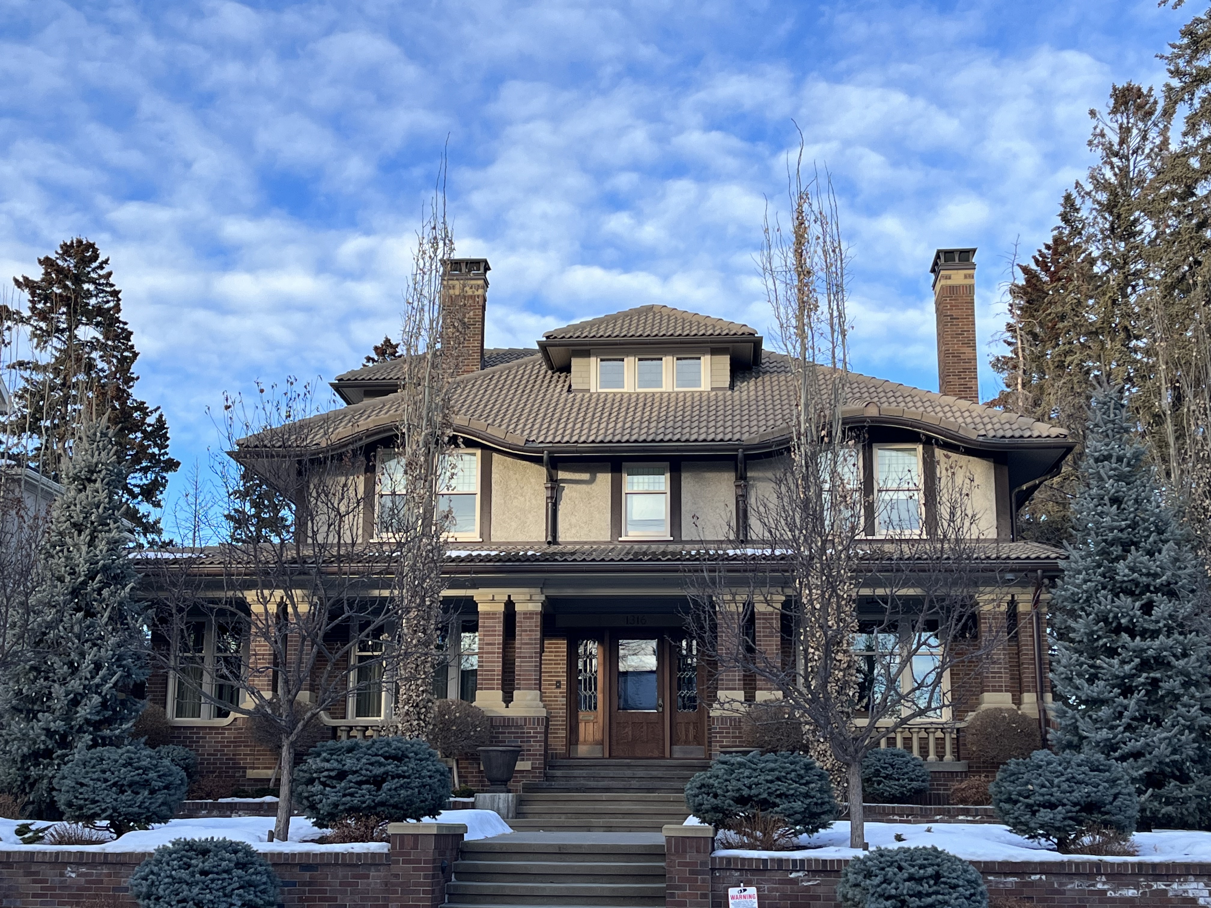
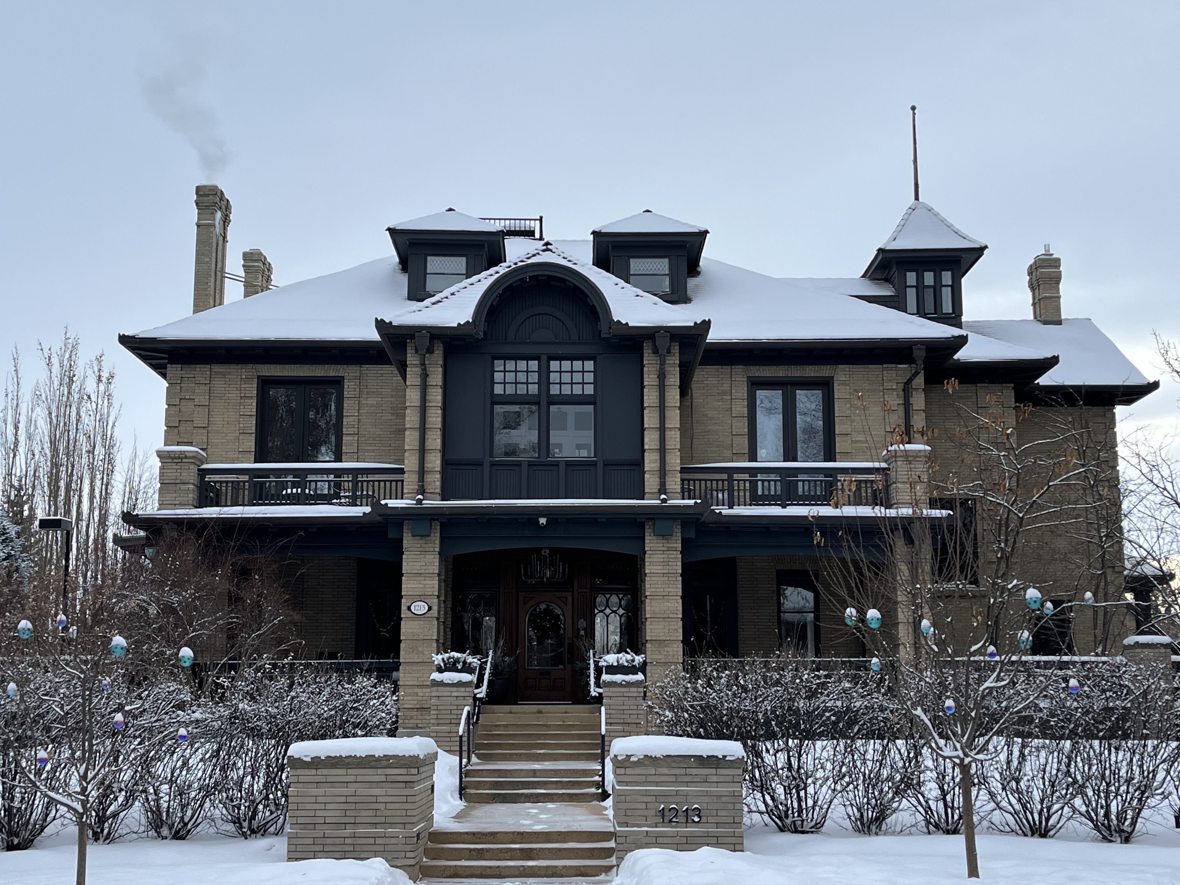
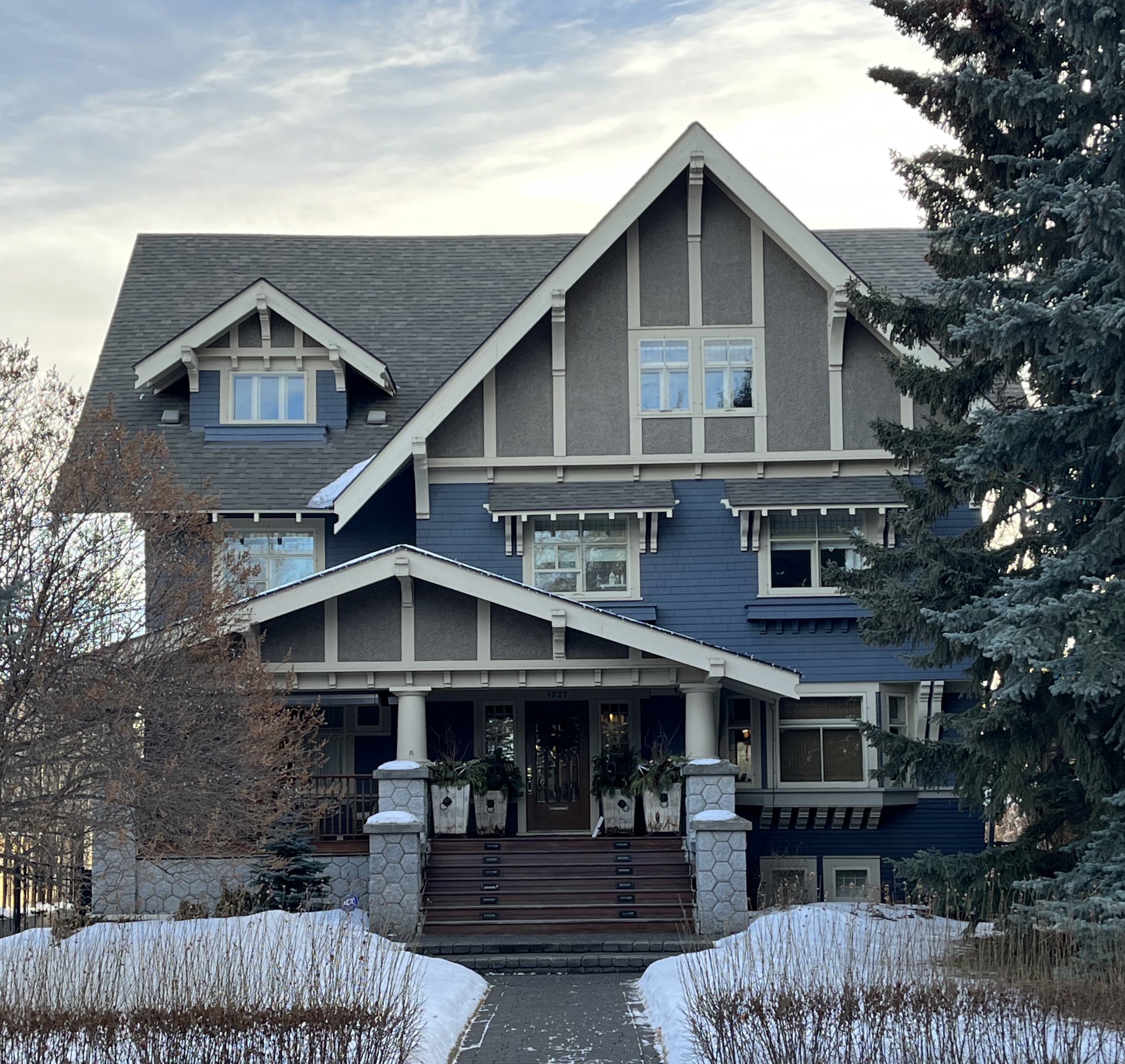
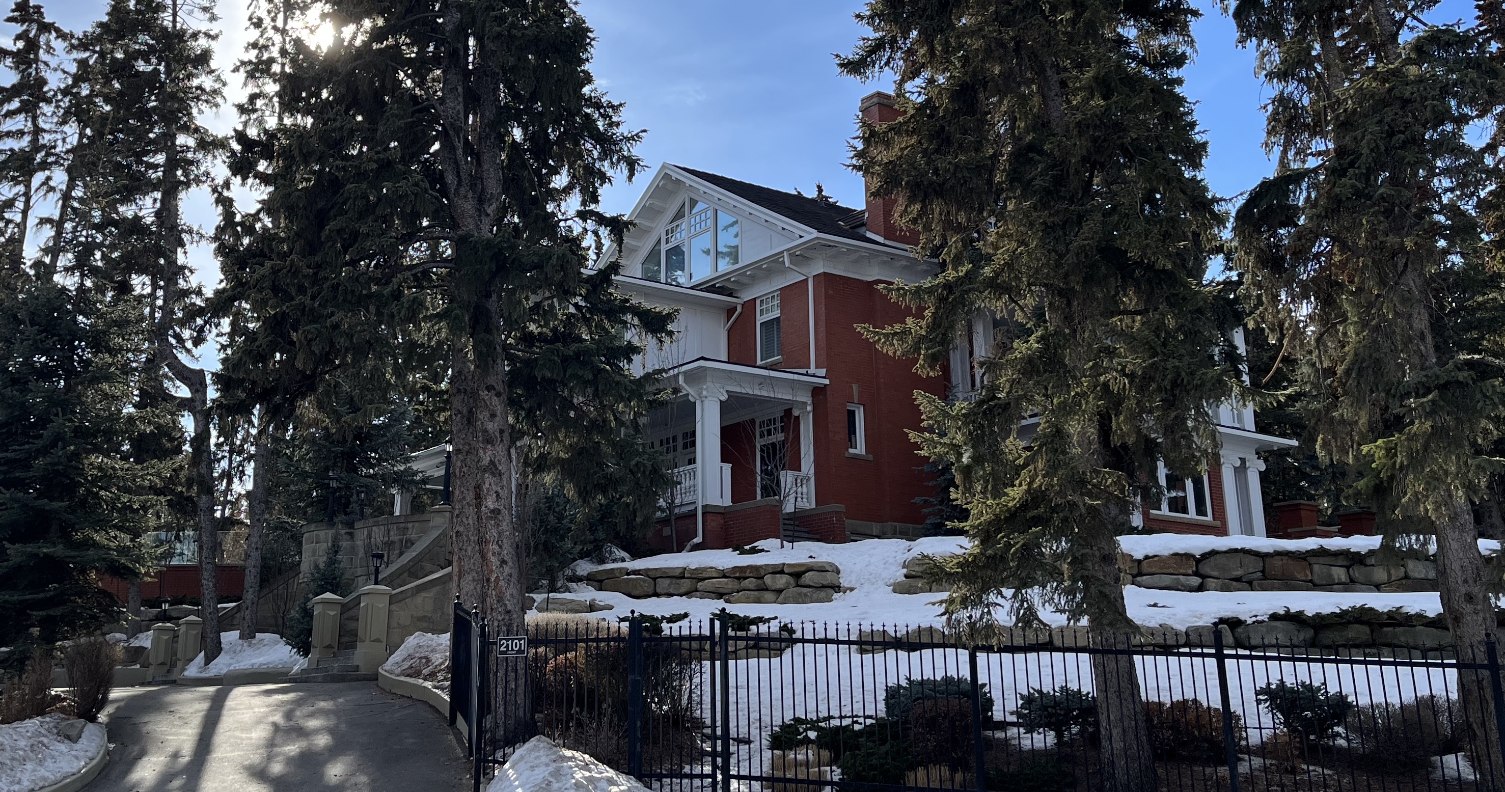
Exploring Prospect Avenue, you witness what was achieved with these examples of homes built between 1912 and 1913. For more information about the inventory of evaluated historic resources, you can access a map by Heritage Calgary here. Or enjoy their full walking tour.
The landscape was inspired by the City Beautiful movement. It was intended to improve the quality of life for inhabitants by creating a “park-like” urban environment. Streets followed the contours of the topography and were situated to make the most of the view.
Lots were large, irregular in shape, with ample setbacks. Side yards enabled residents to add trees and garden features to the barren landscape. The results of this early landscaping can be observed from an overview by comparing Mount Royal to its surroundings. Follow the link to learn how The City of Calgary Values its Urban Forest today.
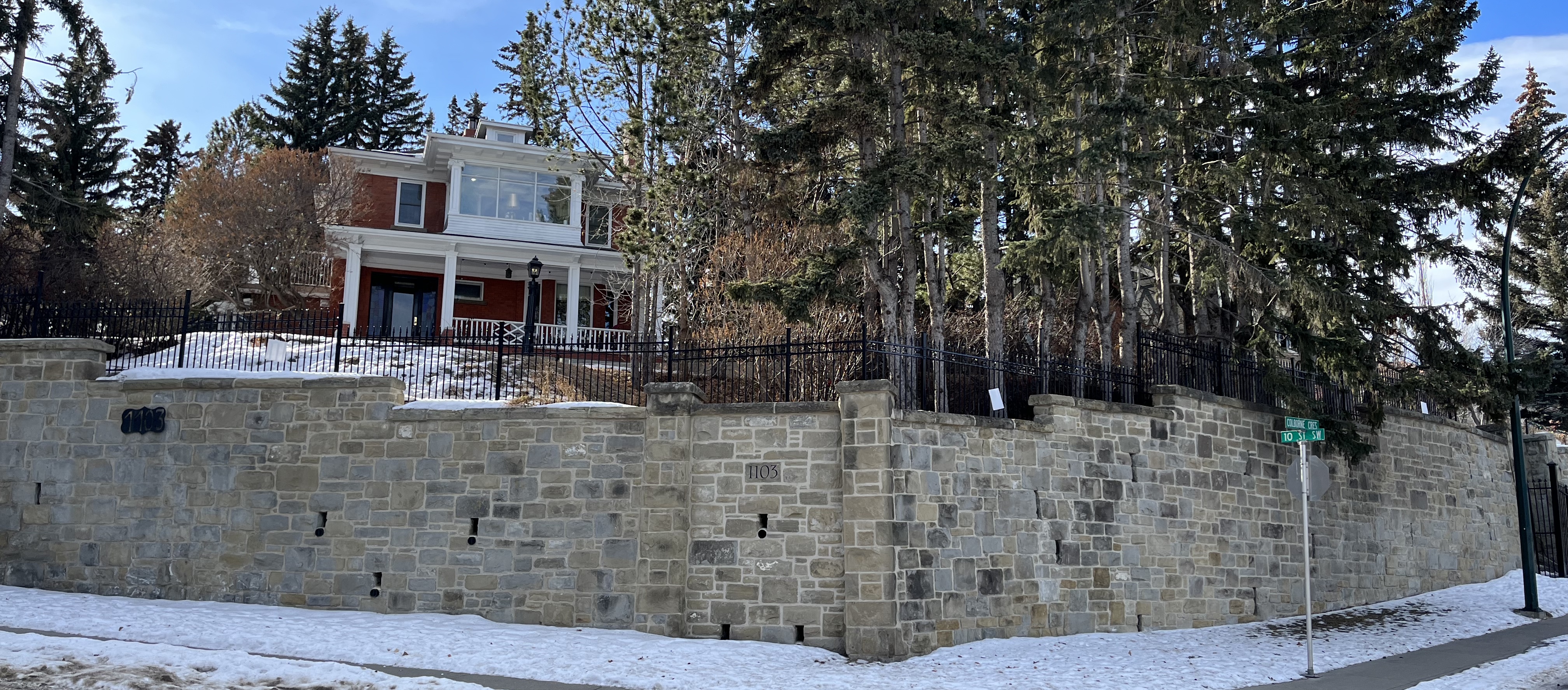
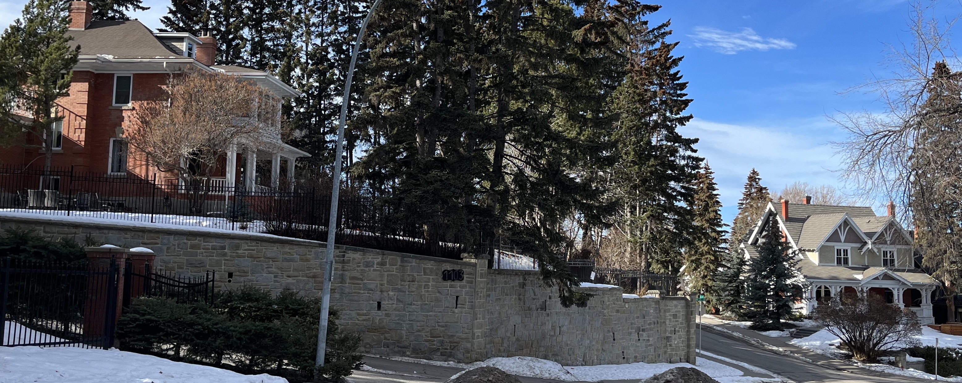
At the Mount Royal Community Association, turn left on 10th St and head down the hill. Halfway down is a massive sandstone wall built in the 1890s by the CPR.
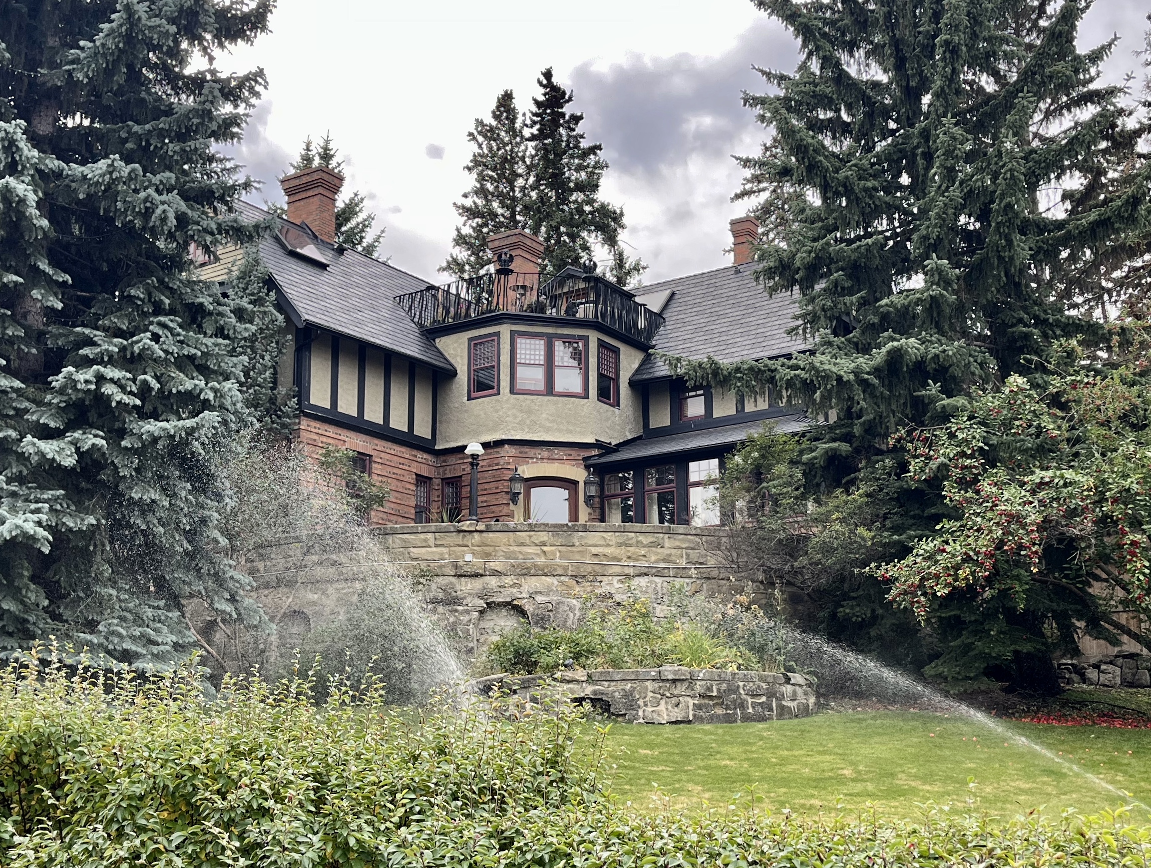
Entrepreneurs from the United States constructed many homes here between 1910 and 1913. This led to the community being called the informal name of American Hill.
Oscar Devenish is one of these entrepreneurs. He built both the Devenish Estate on Durham Avenue and the iconic Devenish Apartments on 17th Avenue.
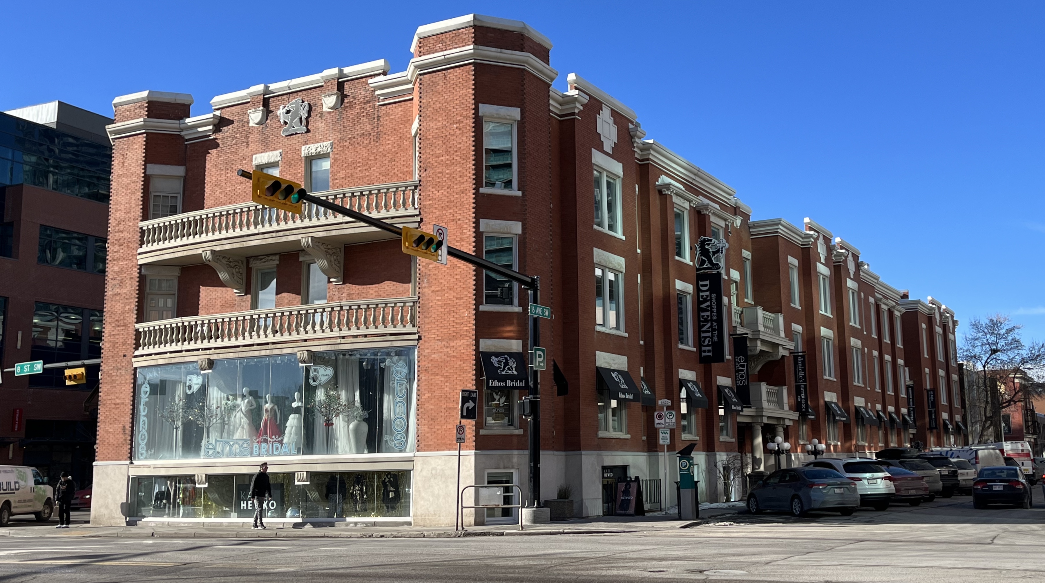
Retail and Entertainment District
Arriving at 17th Avenue, you will have completed 1.17 km and be approximately 15 minutes into your urban hike. The next section is 1.12 km of straight, concrete sidewalk terrain, connected by public art, heritage buildings and green space.
Check out the RED Mile (Retail and Entertainment District) for more information. Depending on how often you stop, it will take around 15 minutes to finish this second section of the loop.
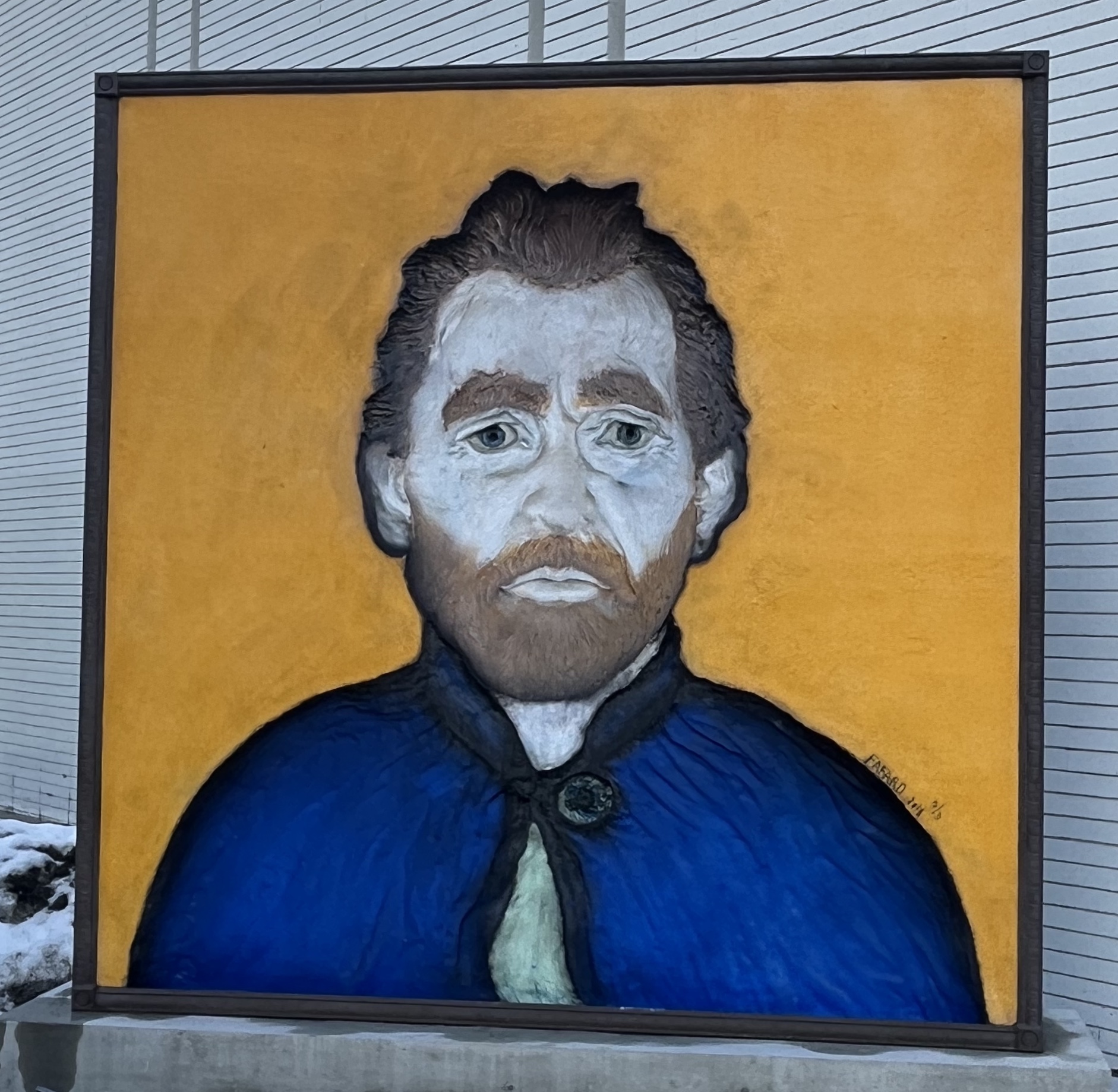
Turn right on Fourth Street. Head south for just over 1 km. You will arrive at the next urban lookout: Van Gogh Obverses. The artwork is in front of Master’s Gallery at 2115 – 4th St. It employs a technique of illusionism known as “hollow face.” The portrait of Van Gogh is captivating. It seems to be observing you as you pass by on the street.
Stepping Up Your Urban Hike
Two blocks south on 22nd Avenue is Evamy Ridge, also known as Hillcrest Hill or Cliff Bungalow Escarpment. This land was gifted to The City from CP Rail in 1920 with the understanding that it would stay parkland.
At the bottom of the stairs in the park are two landmarks. The schools were built during that period in a style unique to Calgary.

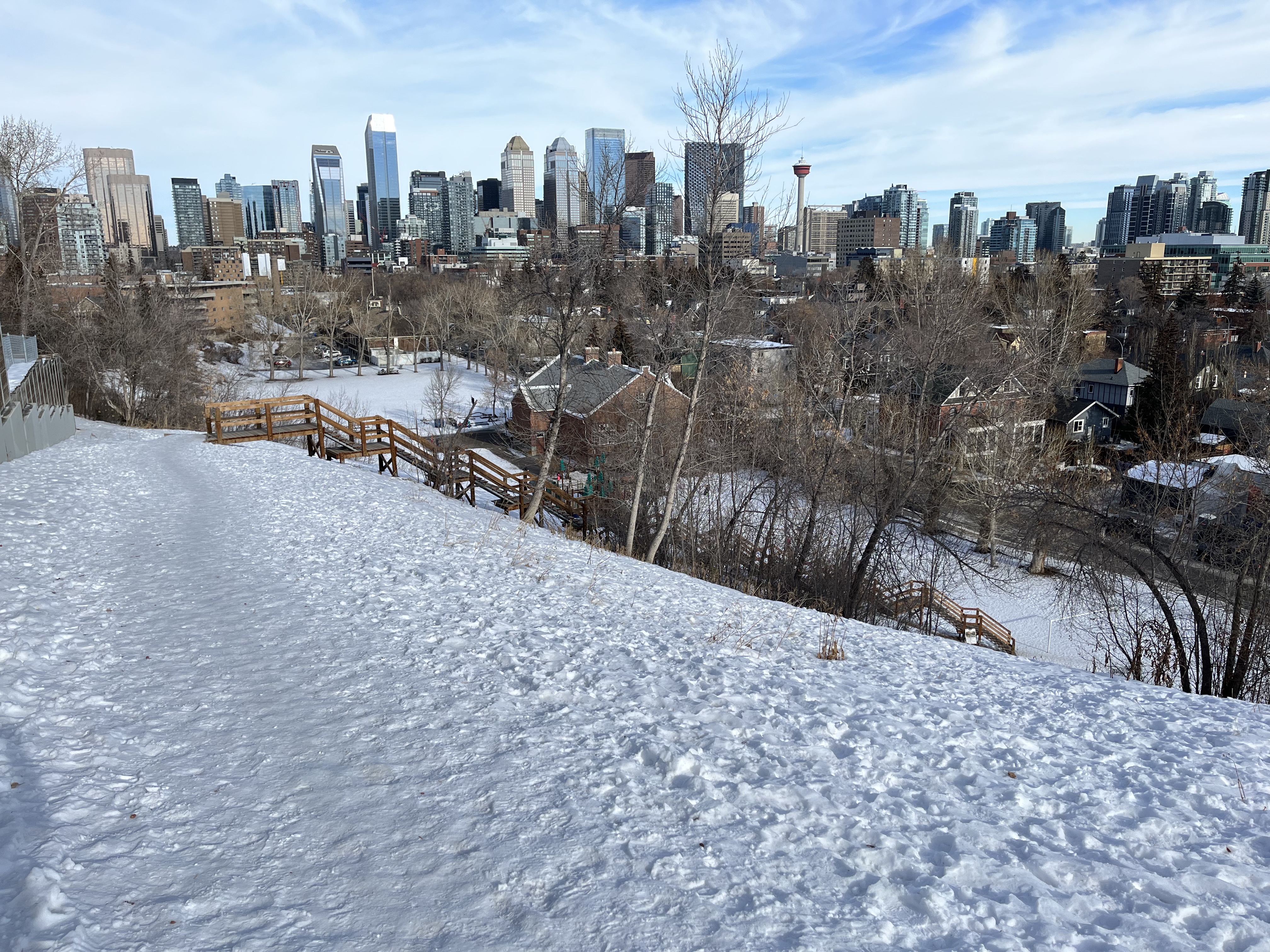
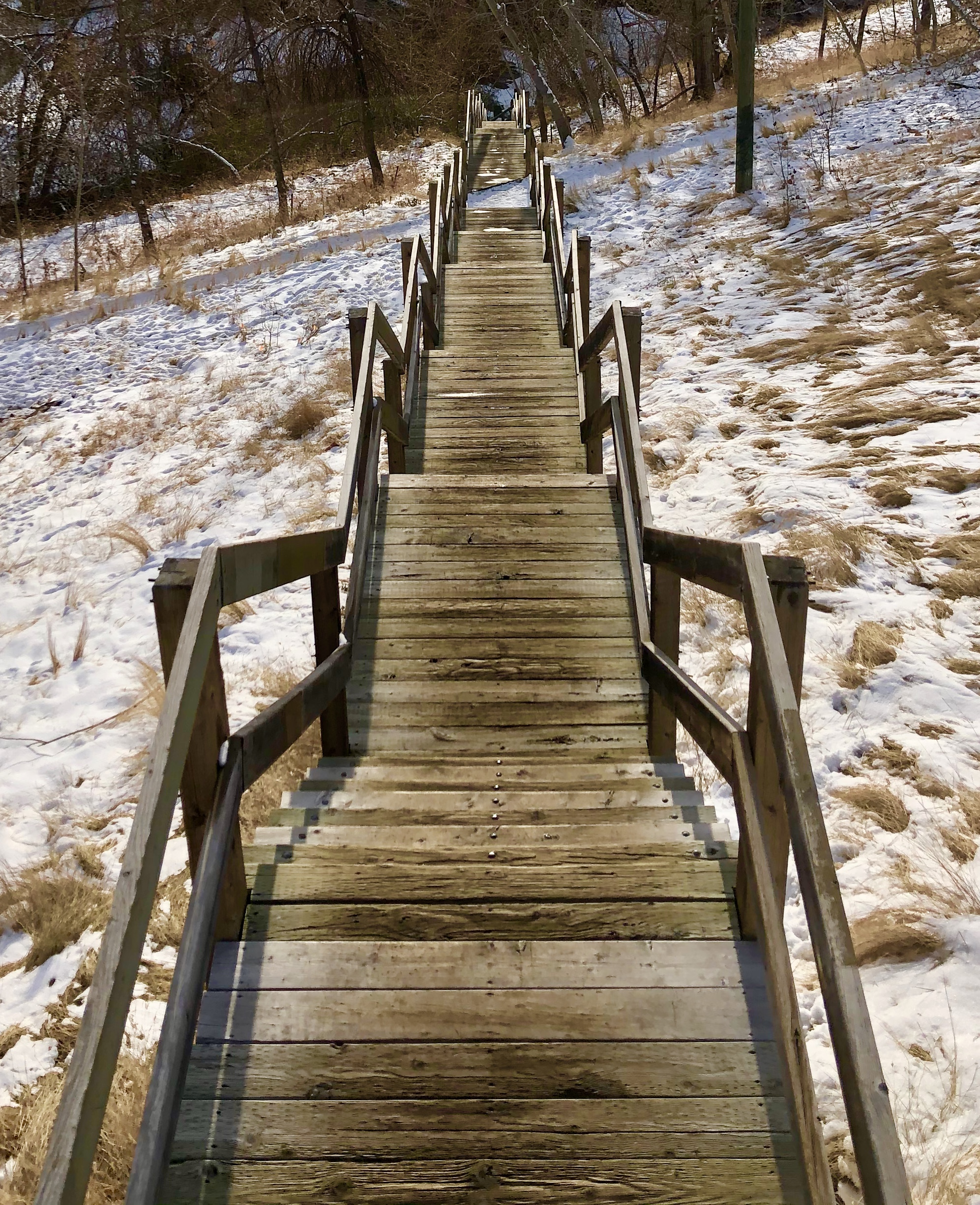
This final leg of your urban hike will be a workout. The view of the city skyline from the summit is worth the effort. This last stretch is approximately 2 km and takes around 30 minutes. The diverse terrain includes trails, wooden stairs and concrete sidewalks.
After climbing up Evamy Ridge, follow the map below to a second set of stairs. You can repeat the stairs to add intensity. Exit at the landing halfway up the hill when you finish.

Heading west through Earl Grey Park, you walk on a trail through a tall, grassy green space. At the end, you head back up the path until you arrive at a roundabout.
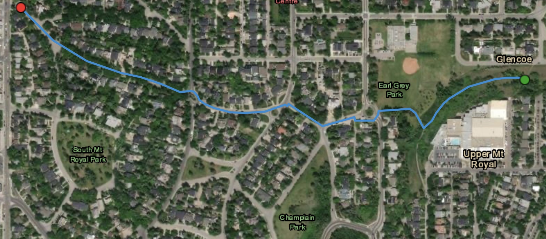
Cross the street and continue heading west on Frontenac Avenue. The urban design features gracefully curving streets and roundabouts. Treed boulevards and open park spaces add to the grandeur of the neighbourhood.
Urban Design – A Garden Suburb
The integral design components of this subdivision were designed by the legendary firm Olmsted Brothers of Brookline. Successors to the famous American landscape architect Fredrick Law Olmsted, with plans based on his suburb-planning principles.
Follow Frontenac Avenue to the starting point or explore Cartier Park. It is the largest of the four original neighbourhood park spaces. Others include Champlain and South Mount Royal Parks.

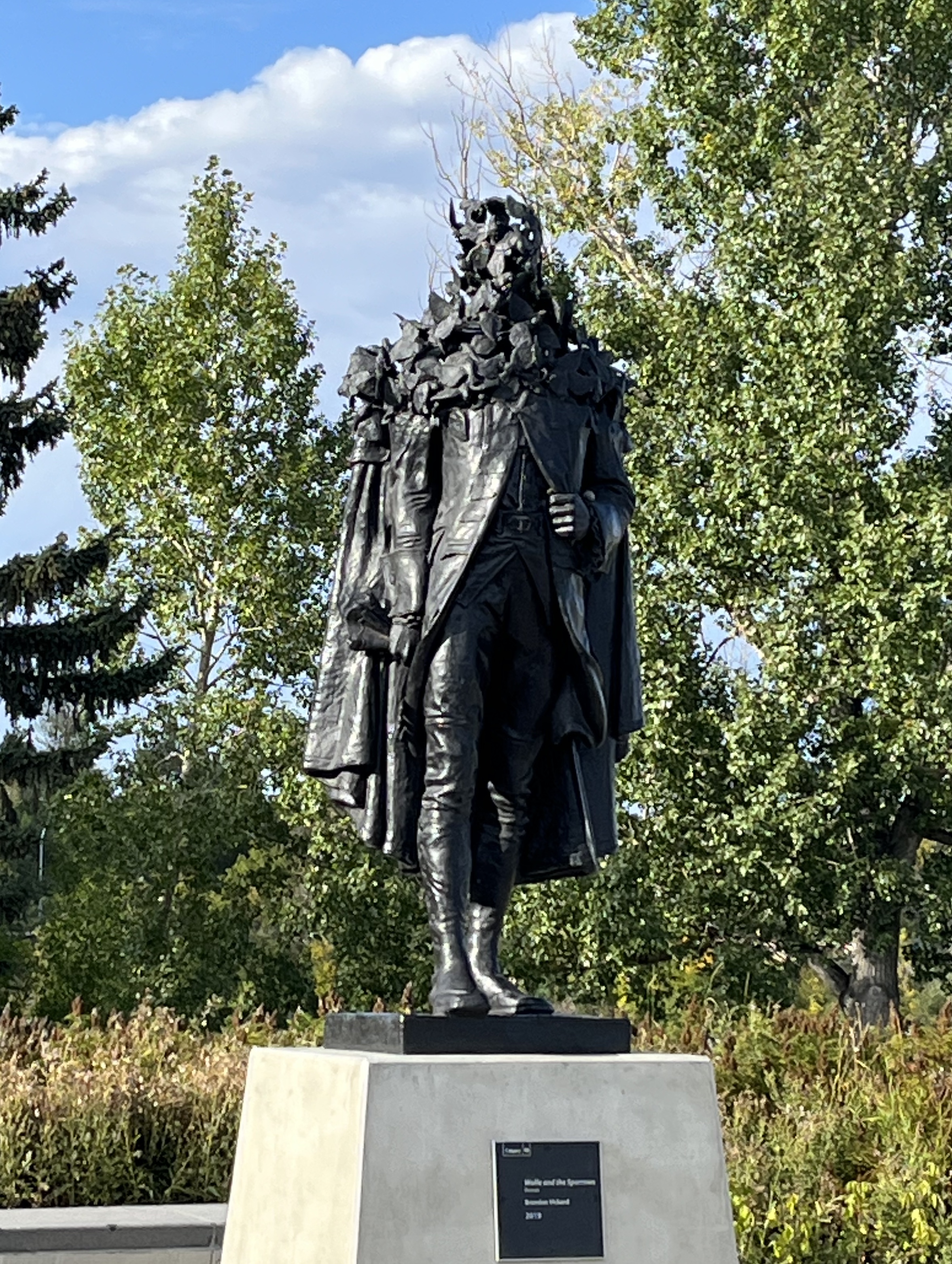
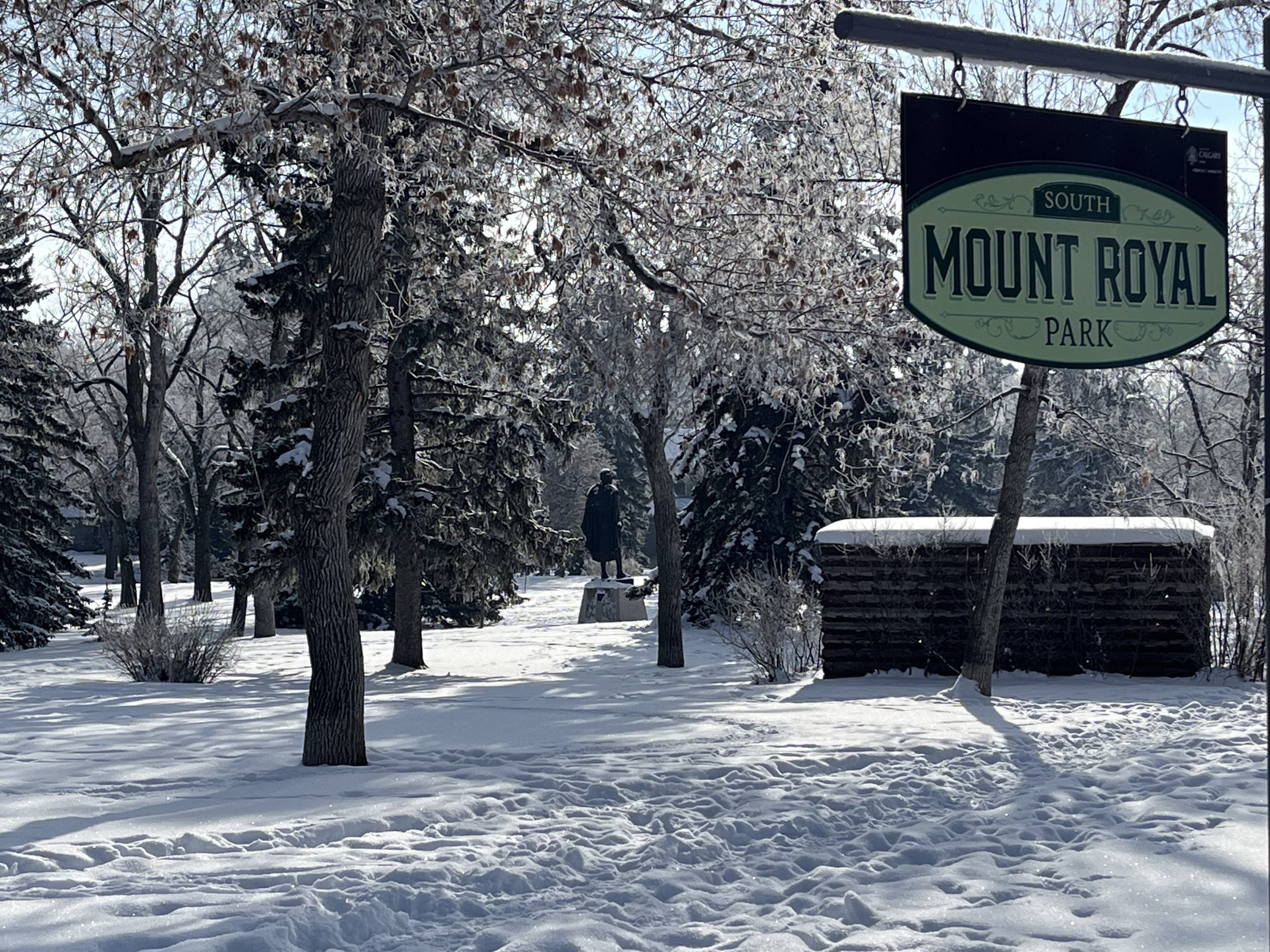
South Mount Royal Park – Wolfe Monument
South Mount Royal Park features a bronze monument depicting British Army General James Wolfe. Created by John Massey Rhind in 1898, it was a gift to The City from Glenbow founder Eric Harvie. Inglewood – An Urban Sanctuary is home to a second public art installation inspired by this original work. It is on the southwest corner of the 12th Street Bridge. In this version by artist Brandon Vickerd (2019), Wolfe’s visage is distorted by a flock of sparrows.
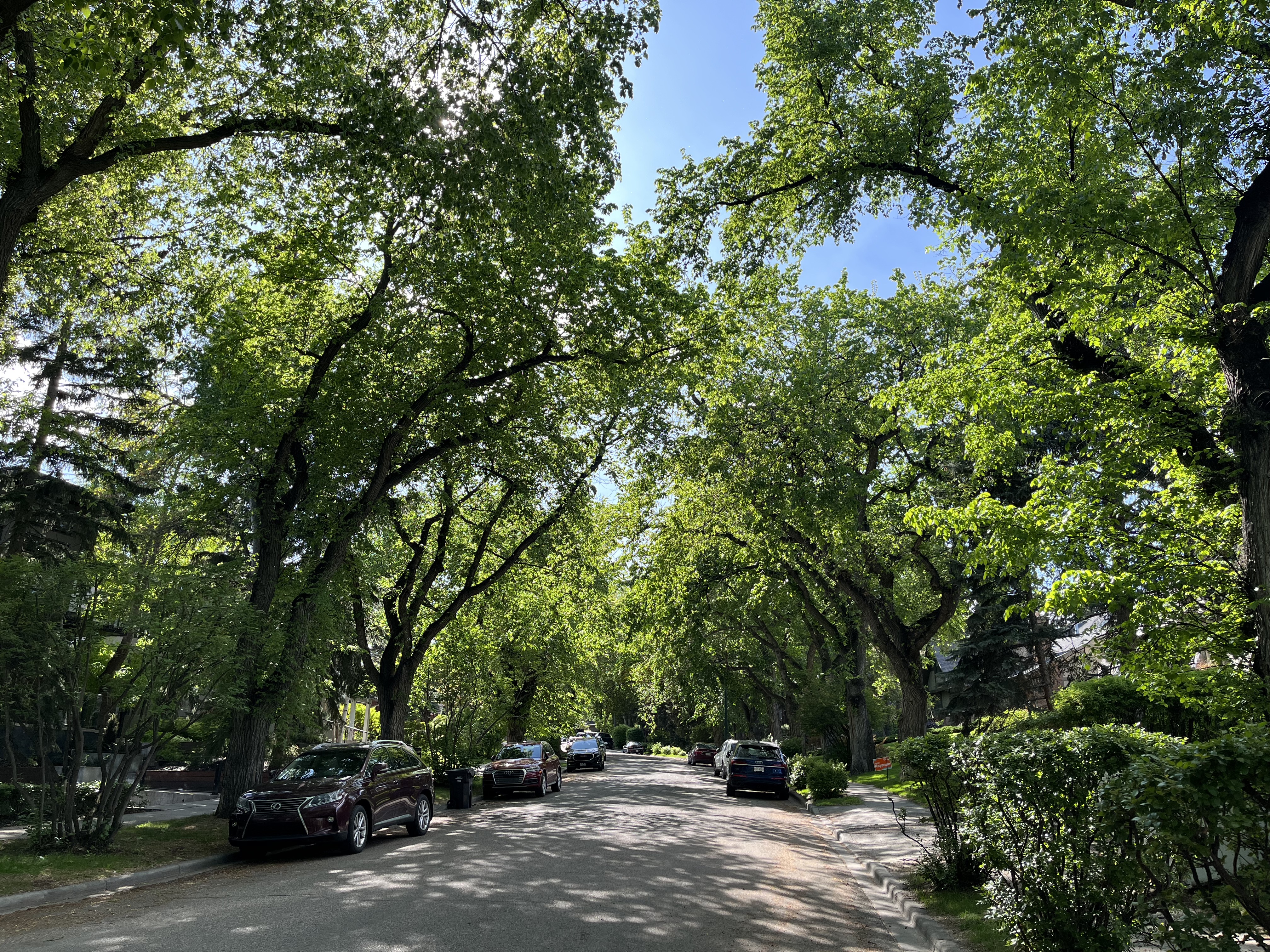
Frontenac Avenue features streets lined with mature American Elm trees. Along with neighbouring Montreal Avenue, they are some of the most picturesque streets in Calgary.
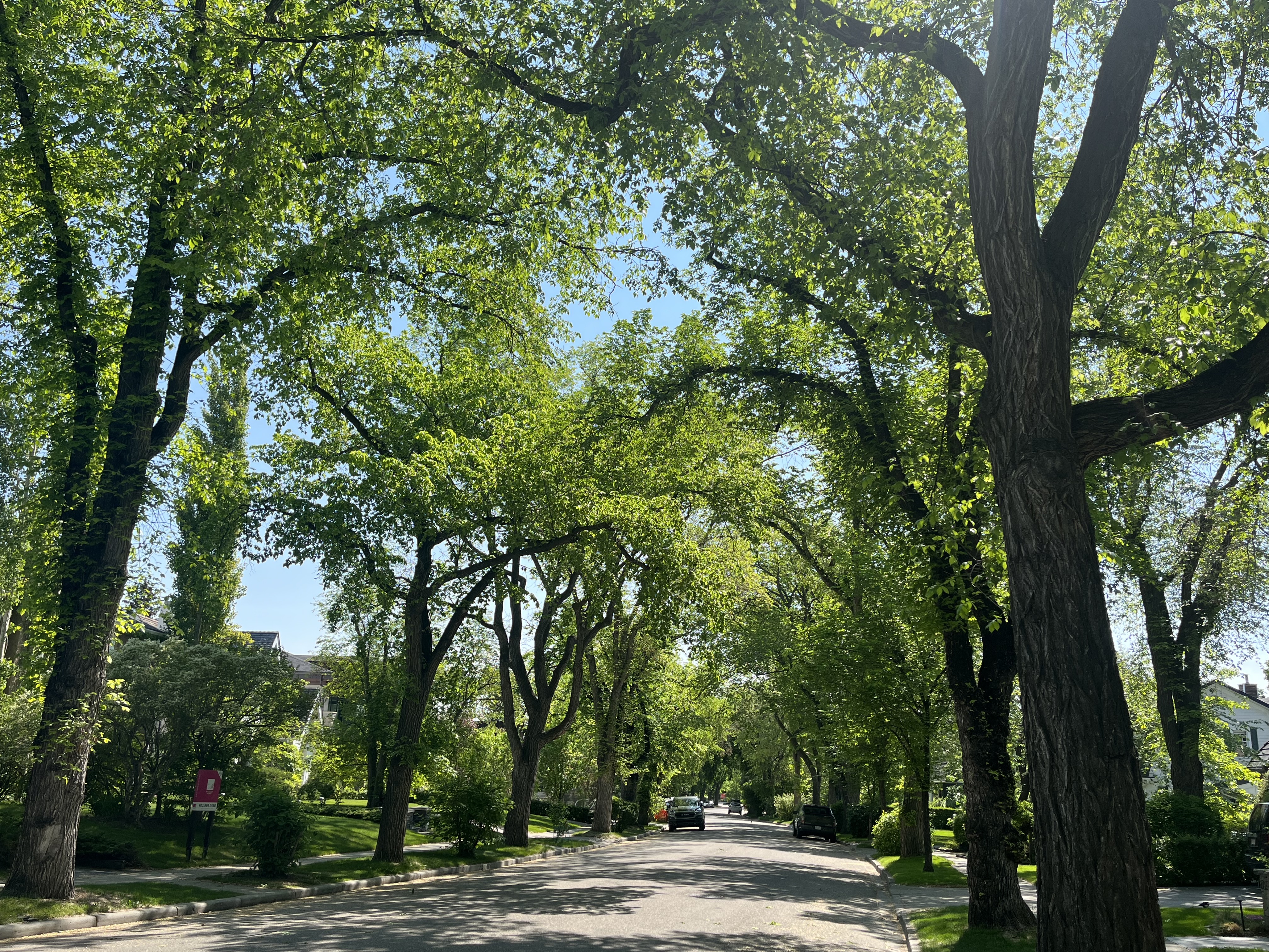
Quebec, Montcalm and Carlton Avenues are all lined with Green Ash trees. This urban forest was planted by William Reader, the city’s most influential Parks Superintendent, in 1929-30. To learn more about the man whose contributions made the many parks and greenspaces possible, explore Reader Rock Garden.
Bringing it Home
The community was named Mount Royal in 1910, after the Montreal district, where CPR president William Van Horne lived. Influential citizens led by future Prime Minister R.B. Bennett and Sir James Lougheed called on the CPR to introduce a designation that better reflected Canadian culture.

The plan for South Mount Royal was registered in 1911. It featured street names of prominent French Canadians: Frontenac, Montcalm, Talon, Laval, Joliet, and Vercheres, the only woman. It also included names of early explorers like Cabot and Champlain, plus places like Montreal, Quebec, and Levis. This brought an end to American Hill and your urban hike.
Credit: Calgary’s Mount Royal – A Garden Suburb by Elise Corbet and Lorne Simpson.
